Waterfall Adventurer
  • Home
  • Waterfalls
    • South Carolina
  • LiDAR
  • Tools
    • QGIS >
      • Download And How To Setup
      • Where To Download LiDAR Data
      • Processing LiDAR Point Cloud Data
      • Opening And Viewing Data
    • The National Map
  • Contact
  • Store
  • Disclaimer
  • More
    • QGIS Tips & Tricks
    • Resources
    • Understanding Waterfall Listings
    • Waterfall Adventurer Facebook Page
    • Waterfall Adventurer YouTube Page

South Carolina Waterfalls

I do hope you find something helpful or interesting, be it a new waterfall that you've never seen, updated trail info for some of the lesser traveled places or just a place to look at beautiful waterfall photos.

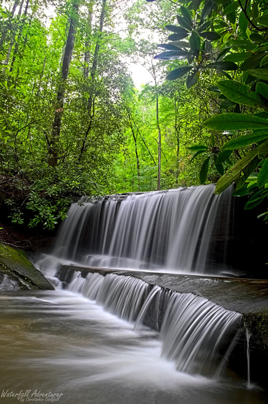
South Carolina is home to many beautiful and unique waterfalls, cascades and shoals. Ranging from the mystical Laurel Fork Falls, which pours directly into Lake Jocassee, Horseshoe Cove Falls in the Pee Dee area, which is the eastern most waterfall in the state, the dainty Peachtree Rock Falls in the Midlands, the impressive 400+ foot Raven Cliff Falls, to the powerful Lower Whitewater Falls on the Whitewater River, with so much more to discover.

Out of all counties in South Carolina that have documented waterfalls, cascades and shoals, Oconee County (known as the Golden Corner) has the most in the state, possibly holding over 800+ waterfalls.

Originally the Upstate was thought to be the only place that had waterfalls in the state, which has turned out to be wrong as waterfalls keep getting found in the Midlands and even the Pee Dee sections of the state, with some being 50+ feet tall.
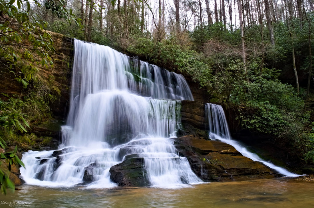
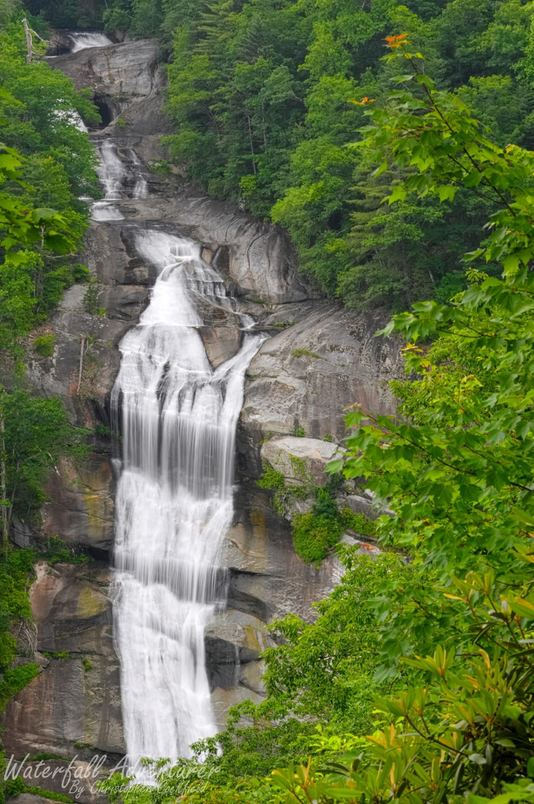
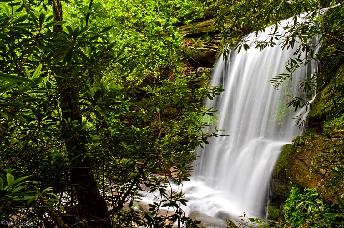
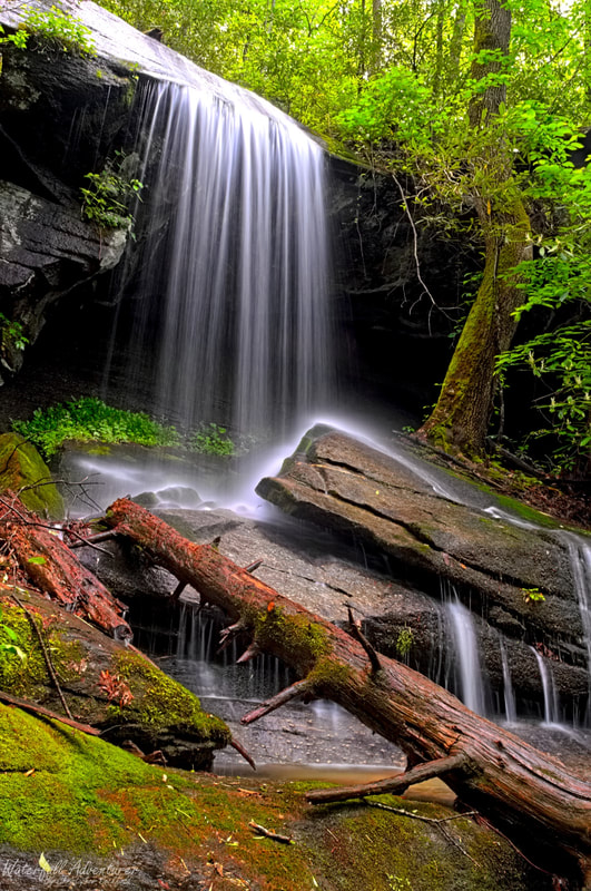
Mountain Cat Falls
Middle Rachael Creek Falls
Lower Whitewater Falls
The very top (1st) photo is the beautiful Virginia Hawkins Falls, the far left (2nd) photo is Mountain Cat Falls, the middle (3rd) photo is Middle Rachael Creek Falls and the far right (4th) photo is Lower Whitewater Falls.

Below is a map with all the named, unnamed and undocumented waterfalls in the state and further down is a list of all the waterfalls by county that I've visited in the state. The color of each marker corresponds with the type of property it is and by default the blue markers are on, the red, black, green and orange markers are hidden, to view them click the double arrows in the top left of the map and click each box that you want to see.
Blue = public property, red = private property, green = public unnamed / LiDAR, orange = private unnamed / LiDAR,
black = restricted property and restricted unnamed / LiDAR.

Aiken County

Chester County

  • Caney Fork Falls
  • Quarry Falls

Chesterfield County

  • Old 601 Bridge Shoals

Florence County

  • Chasm Falls
  • Horseshoe Cove Falls
  • Horseshoe Cove Falls (Upper)
  • Punchbowl Falls
  • Sparrow Swamp Shoals

Kershaw County

  • Flat Rock Creek Falls
  • Raley Millpond Shoals

Laurens County

Lancaster County

  • Astonishing Falls
  • Campbridge Falls
  • Campbridge Falls (Lower)
  • Fortress Falls
  • Hidden Falls
  • Lick Run Falls
  • Little Cedar Falls
  • Little Falls
  • Mossy Fern Falls
  • Old 601 Bridge Shoals
  • Rockhouse Falls
  • Subterranean Falls
  • Triple Falls

Lexington County

  • Peachtree Rock Falls

Greenville County

  • Blue Wall Falls
  • Blue Wall Falls (Lower)
  • Cedar Falls
  • Chute Falls
  • Evans Falls
  • Falls Creek Falls
  • Falls Creek Falls (Lower)
  • Falls Creek Falls (Upper)
  • Heritage Falls
  • Heritage Falls (Lower)
  • Jones Gap Falls
  • Last Falls
  • Mash Box Falls
  • Matthews Creek Falls (Upper)
  • Misty Falls
  • New Millenium Falls (Middle)
  • New Millenium Falls (Upper)
  • Pleasant Ridge Falls
  • Rainbow Falls
  • Raven Cliff Falls
  • Raven Cliff Falls (Upper)
  • Reedy River Falls
  • Reedy River Falls (Lower)
  • Spider Tunnel Falls
  • Sulphur Springs Trail Falls (#1)
  • Sulphur Springs Trail Falls (#2)
  • Sulphur Springs Trail Falls (#3)
  • Sulphur Springs Trail Falls (#4)
  • Sulphur Springs Trail Falls (#5)
  • Sulphur Springs Trail Falls (#6)
  • Sweet Thing
  • Sweetest Thing Falls
  • Wildcat Branch Falls (Lower)
  • Wildcat Branch Falls (Middle)
  • Wildcat Branch Falls (Upper)
  • Wildcat Branch Trail Falls
  • Wildcat Branch Trail Falls (Upper)

Oconee County

Oconee County waterfalls are being updated, so some things are missing.
  • Andrew Ramey Falls
  • Anomaly Falls
  • Battle Creek Canyon Falls
  • Battle Creek Falls
  • Bee Cove Falls (#1)
  • Bee Cove Falls (#2)
  • Bee Cove Falls (#3)
  • Bee Cove Falls (#4)
  • Bent Beech Falls
  • Big Bend Falls
  • Big Boulder Falls
  • Big Howard Falls (Upper)
  • Big Winding Stairs Falls
  • Blue Hole Falls
  • Blueless Falls (Lower)
  • Blueless Falls (Middle)
  • Blueless Falls (Upper)
  • Bone Camp Creek Falls
  • Brasstown Falls (Lower)
  • Brasstown Falls (Middle)
  • Brasstown Falls (Upper)
  • Bull Sluice
  • Camp Branch Falls
  • Cedar Creek Falls
  • Chauga Narrows
  • Chemical Creek Canyon Falls
  • Chemical Creek Falls (Upper)
  • Chemical Creek Falls (Middle)
  • Cheohee Road Falls
  • Connector Falls (Lower)
  • Connector Falls (Upper)
  • Crane Creek Falls
  • Crane Creek Falls (Lower)
  • Crane Creek Falls (Middle)
  • Crane Falls
  • Crane Falls (Upper)
  • Crossing Falls
  • Crossland Creek Falls
  • Daniel Falls
  • Deadfall Falls
  • Delicate Falls
  • Divided Falls
  • Double Branch Falls
  • Don's Falls
  • Fall Creek Falls
  • Final Falls
  • Grandiose Falls
  • Grapevine Hell Falls
  • Hellbender Falls (Lower)
  • Hellbender Falls (Upper)
  • Hidden Paradise Falls
  • Howard Creek Falls (Lower)
  • Howard Creek Falls (Middle)
  • Howard Creek Falls (Upper)
  • Infinity Pool Falls
  • Issaqueena Falls
  • Jack Pulpit Falls
  • Jade Falls
  • John Danner Falls
  • John Danner Falls (Lower)
  • King Creek Falls
  • Land Bridge Falls
  • Lee Falls
  • Licklog Falls
  • Licklog Falls (Middle)
  • Licklog Falls (Upper)
  • Limber Pole Creek Falls
  • Limber Pole Creek Falls (Upper)
  • Limestone Falls
  • Little Blueless Falls
  • Little Brasstown Falls
  • Little Crane Creek Falls
  • Little Fall Creek Falls
  • Little Limber Pole Creek Falls
  • Little Opossum Creek Falls
  • Little Yellow Branch Falls
  • Lohr's Falls
  • Long Creek Falls
  • Long Creek Falls (Middle)
  • Long Creek Falls (Upper)
  • Longnose Falls
  • Maxie Duke Falls
  • Mellow Yellow Falls
  • Midway Falls
  • Mini Yellow Branch Falls
  • Moondance Falls
  • Obscured Falls
  • Opossum Creek Falls
  • Opossum Creek Falls (Upper)
  • Overhang Falls
  • Overlook Falls
  • Pigpen Falls
  • Pigpen Falls (Upper)
  • Pitfall Falls
  • Pristine Falls
  • Prince Falls
  • Princess Veil Falls
  • Prospector Falls
  • Queen Falls
  • Ramsey Creek Falls
  • Raines Mill Falls (Lower)
  • Raines Mill Falls (Middle)
  • Raines Mill Falls (Upper)
  • Reedy Branch Falls
  • Riley Moore Falls
  • Rhodo Falls
  • Rockjaw Falls
  • Rocky Cascade
  • Rose Falls
  • Secret Falls
  • Secret Falls (Lower)
  • Serpent Falls
  • Shelter Rock Falls
  • Shine Falls
  • Shiver Me Timber Falls
  • Side Pocket Falls
  • Sid's Falls
  • Skookum Falls
  • Slatten Branch Falls
  • Sloan Bridge Falls (Lower)
  • Sloan Bridge Falls (Upper)
  • Sparkle Falls
  • Spider Valley Falls
  • Spider Valley Falls (Lower)
  • Spider Valley Falls (Middle)
  • Split Personality Falls
  • Spoonauger Falls
  • Spoonauger Falls (Lower)
  • Station Cove Falls
  • Super Secret Falls
  • Tumbling Falls
  • Twin Cove Falls
  • Verdant Falls
  • Undercut Falls
  • Very Secret Falls
  • Wash Branch Falls (Upper)
  • Whetstone Falls
  • Whetstone Falls (Upper)
  • Whitewater Falls (Lower)
  • Who Knew Falls
  • Wimoweh Falls
  • Wimoweh Falls (Upper)
  • Woodall Shoals
  • Yellow Branch Falls
  • Yellow Branch Falls (Lower)
  • Yellow Branch Falls (Middle)
  • Yellow Branch Falls (Upper)
  • Yellow Jacket Falls

Pickens County

  • Alewine Falls
  • Allie's Falls
  • Amelia Falls
  • Beech Bottom Falls (Pinnacle Falls)
  • Big Bully Falls
  • Camp McCall Falls
  • Cane Creek Falls
  • Cane Creek Falls (Lower)
  • Cane Creek Falls (Middle)
  • Carrick Creek Falls
  • Christopher Falls
  • Chuck Barkley Falls
  • Chuck E Cheese Falls
  • Chuck D Falls
  • Chuck Liddell Falls
  • Chuck Norris Falls
  • Creekside Falls
  • Crosscut Falls
  • Dead Snake Falls
  • Determination Falls
  • Distillery Falls
  • Distillery Falls (Lower)
  • Divinity Falls
  • Doghobble Hell Falls (Lower)
  • Doghobble Hell Falls (Middle)
  • Duality Falls
  • ​Eastern Horse Pasture Road Falls
  • Eden Falls
  • Elusive Falls
  • Enchanted Falls
  • Euphoria Falls
  • Evil Ducky Falls
  • Fellowship Falls
  • Forgotten Cove Falls
  • Grassy Falls
  • Grotto Falls
  • Hidden Veil Falls
  • ​Horse Pasture Road Falls
  • Jumble Falls
  • Kinney Branch Falls
  • Kinney Branch Falls (Middle)
  • Kinney Branch Falls (Upper)
  • Laurel Fork Falls
  • Little Bully Falls
  • Long Shoals
  • Meadow Falls
  • Memorial Cove Falls
  • Mizelle Falls
  • Mossy Falls
  • Mossy Cove Falls
  • Mountain Cat Falls
  • Narrow Canyon Falls
  • Never Ending Falls
  • Nine Times Falls
  • Nine Times Falls (Lower)
  • Nine Times Falls (Middle)
  • Not So Rachael Falls
  • Out Of Sight Falls
  • Palmetto Falls
  • Palmetto Trail Falls
  • Poe Creek Falls (Lower)
  • Poe Creek Falls (Middle)
  • Poe Creek Falls (Upper)
  • Pork Chop Falls
  • Pork Chop Falls (Lower)
  • Prince Cove Falls
  • Rachael Creek Falls
  • Rachael Creek Falls (Middle)
  • Rachael Creek Falls (Upper)
  • Rachaels Raceway
  • Rachaels Rock Garden
  • Rhododendron Falls
  • Sanctum Falls
  • Sandy Beach Cascade
  • Silver Ribbon Falls
  • Sluice Falls
  • Spelunker Falls
  • Staircase Falls
  • Stinger Falls
  • Sunder Falls
  • Tiger Falls
  • Todd Creek Falls
  • Todd Creek Trib Falls
  • Trailside Falls
  • Trillium Valley Falls
  • Trillium Valley Falls (Lower)
  • Trillium Valley Falls (Upper)
  • Triple Falls (Reedy Cove Creek)
  • Triple Falls (Tributary of Eastatoe Creek)
  • Twin Falls
  • Umbrella Rock Falls
  • Up Chuck Falls
  • Vespa Falls
  • Virginia Hawkins Falls
  • Waldrop Stone Falls
  • Waldrop Stone Falls (Upper)
  • Waterfall Downstream Of Lower Willis Creek Falls
  • Waterfall Upstream Of Upper Willis Creek Falls
  • Western Horse Pasture Road Falls
  • Wildcat Creek Falls
  • Willis Creek Falls (Lower)
  • Willis Creek Falls (Upper)
  • Woodchuck Falls
  • Yucca Falls
  • Yucca Falls (Lower)

Spartanburg County

  • Buffalo Creek Falls
  • Glendale Shoals
  • Horseshoe Falls
  • Frey Creek Falls

York County

Powered by Create your own unique website with customizable templates.
  • Home
  • Waterfalls
    • South Carolina
  • LiDAR
  • Tools
    • QGIS >
      • Download And How To Setup
      • Where To Download LiDAR Data
      • Processing LiDAR Point Cloud Data
      • Opening And Viewing Data
    • The National Map
  • Contact
  • Store
  • Disclaimer
  • More
    • QGIS Tips & Tricks
    • Resources
    • Understanding Waterfall Listings
    • Waterfall Adventurer Facebook Page
    • Waterfall Adventurer YouTube Page