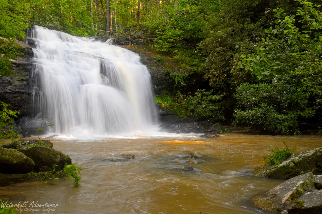
Middle Long Creek Falls
- Height: 28 feet
- Type: Cascading free-fall
- Stream: Long Creek
- River Basin: Savannah River
- Elevation: 1,314 feet
- Landowner: U.S. Department of Agriculture
- Recreational Area: Sumter National Forest, Andrew Pickens Ranger District
- State: South Carolina
- County: Oconee
- USGS Map: Rainy Mountain
- Difficulty: Strenuous to very strenuous
- Accessibility: Logging road, bushwhack & creek crossing
- Trail Blaze: None
- Admission Fee: None
- Hike Length: 2.6 miles
- Waterfall GPS: 34.78062 -83.29307
- Parking GPS: 34.76769 -83.29242
Overview
Driving Directions
From Westminster, South Carolina. From the intersection of US-123, head north on US-76 for 12.9 miles and turn left onto Damascus Church Road. Drive 0.8 miles and turn right onto Battlecreek Road. Drive 1.4 miles and park on the right side of the road, just pass a mounded up dirt road on the right side of the road.
From Clayton, Georgia. From the intersection of US-441, head east on US-76 for 10.7 miles and turn right onto Orchard Road. Drive 2.4 miles and turn right onto Battlecreek Road. Drive 1 mile and park on the right side of the road, just pass a mounded up dirt road on the right side of the road.
From Clayton, Georgia. From the intersection of US-441, head east on US-76 for 10.7 miles and turn right onto Orchard Road. Drive 2.4 miles and turn right onto Battlecreek Road. Drive 1 mile and park on the right side of the road, just pass a mounded up dirt road on the right side of the road.
Hiking Directions
From the parking. Walk back to the mounded up dirt road and follow it for 0.53 miles to where the big dirt road ends. (You'll pass by 3 smaller dirt roads.) Head northwest for 260+ feet to the top of the hill (34.77580 -83.29186) and then head west, following a logging road around the valley. Follow the logging road for about 0.30 miles to the end (34.77862 -83.29229.) Go east and head down the side of the mountain for 450+ feet to the creek (Was flagged 3/27/2018.) Once at the creek, wade across to the other side (Do not attempt to cross the creek if the water is up!) and climb up the side of the hill and head downstream for 250+ feet, where you'll pass by Upper Long Creek Falls. Continue following the creek downstream for 740+ feet to where you can drop just downstream of the falls.
The road leading back is grown up in the warmer months.
My GPS track can be found below. Click on the track name to be taken to the Gaia GPS website where you can save the track to your phone or computer.
The road leading back is grown up in the warmer months.
My GPS track can be found below. Click on the track name to be taken to the Gaia GPS website where you can save the track to your phone or computer.
