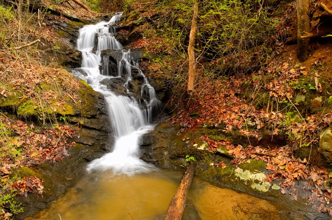
Jack Pulpit Falls
- Height: 32 feet
- Type: Cascade into cascading potholes
- Stream: Station Creek
- River Basin: Savannah River
- Elevation: 1,244 feet
- Landowner: U.S. Department of Agriculture
- Recreational Area: Sumter National Forest, Andrew Pickens Ranger District
- State: South Carolina
- County: Oconee
- USGS Map: Walhalla
- Difficulty: Very strenuous
- Accessibility: Trail & bushwhack
- Trail Blaze: Blue & yellow
- Admission Fee: None
- Hike Length: 2.46 miles
- Waterfall GPS: 34.85017 -83.08624
- Parking GPS: 34.84884 -83.07439
Overview
Jack Pulpit Falls gets it's name from the Jack in the pulpit plants that grow in the bog near the waterfall.
Driving Directions
From West Union, South Carolina. From the intersection of SC-28, head north on SC-11 for 6.2 miles and turn left onto Oconee Station Road. Drive 2.3 miles and turn left into the parking.
From Salem, South Carolina. From the intersection of SC-130, head south on SC-11 for 6.7 miles and turn right onto Oconee Station Road. Drive 2.3 miles and turn left into the parking.
From Salem, South Carolina. From the intersection of SC-130, head south on SC-11 for 6.7 miles and turn right onto Oconee Station Road. Drive 2.3 miles and turn left into the parking.
Hiking Directions
From the parking. Follow the trail behind the kiosk for 0.25 miles to a bridge crossing. Once across continue for another 0.24 miles to another bridge crossing. Continue following the trail for 550+ feet to a trail junction with a wooden fence, head right and follow the Palmetto Trail. Follow the trail for 0.5 miles to where the Palmetto Trail curves right and a ridge to your left that heads downhill.
Follow the ridge down to the creek, sliding and crawling under rhodo. You'll hopefully come out just upstream of the brink of Station Cove Falls. (Stay away from the brink, as a fall would definitely kill you!) Head upstream to Twin Cove Falls and carefully climb up the left side of the falls (River right.) Once above the falls, carefully cross the creek and climb up the hill to get too the other creek that makes up the river left side of Twin Cove Falls. Once at the creek carefully walk upstream to the falls. Do not walk in the bog as there is rare plants that grow in it!
My GPS track can be found below. Click on the track name to be taken to the Gaia GPS website where you can save the track to your phone or computer.
