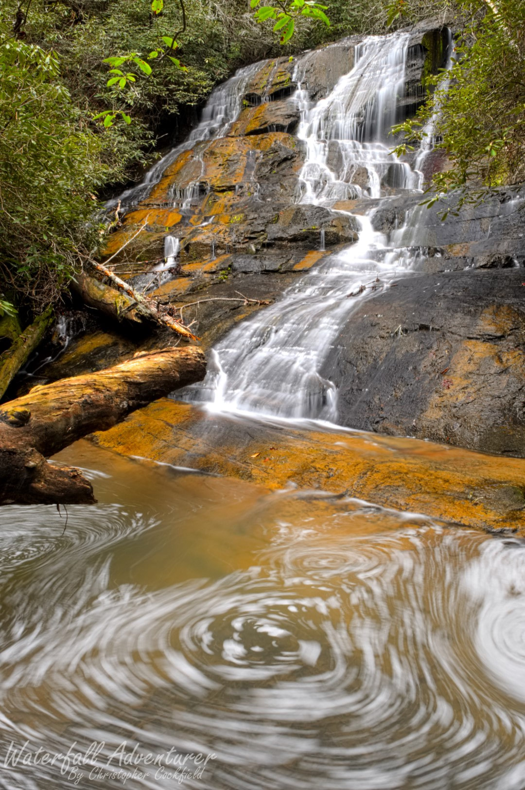
Lohr's Falls
- Height: 44 feet
- Type: Steep cascade
- Stream: Tributary of Yellow Branch
- River Basin: Savannah River
- Elevation: 1,438 feet
- Landowner: U.S. Department of Agriculture
- Recreational Area: Sumter National Forest, Andrew Pickens Ranger District
- State: South Carolina
- County: Oconee
- USGS Map: Whetstone
- Difficulty: Moderate to strenuous
- Accessibility: Trail & bushwhack
- Trail Blaze: None
- Admission Fee: None
- Hike Length: 2 miles
- Waterfall GPS: 34.79727 -83.13607
- Parking GPS: 34.80579 -83.12864
Overview
Norman Arnold named this waterfall after the Lohr family, who found it after getting lost on their way back from Yellow Branch Falls.
Driving Directions
From Walhalla, South Carolina. From the intersection of SC-183, head west on SC-28 for 5.3 miles and turn left onto Yellow Branch Road. Keep left at the fork and drive until it ends into the big parking.
From Cashiers, North Carolina. From the intersection of US-64, head south on NC-107 for 8.2 miles to the NC/SC border, where NC-107 turns into SC-107. Continue following SC-107 for 15 miles and turn left onto SC-28. Drive 2.8 miles and turn right onto Yellow Branch Road. Keep left at the fork and drive until it ends into the big parking.
From Cashiers, North Carolina. From the intersection of US-64, head south on NC-107 for 8.2 miles to the NC/SC border, where NC-107 turns into SC-107. Continue following SC-107 for 15 miles and turn left onto SC-28. Drive 2.8 miles and turn right onto Yellow Branch Road. Keep left at the fork and drive until it ends into the big parking.
Hiking Directions
From the parking. On the south side of the parking is the beginning of the Yellow Branch Falls Trail. Follow the trail for 750+ feet where you'll come to your first creek crossing. Once across continue for 70+ feet and cross the creek again at the base of a nice cascade, 200+ more feet and you'll cross the creek once again. Once across continue following the trail for 280+ feet to a T intersection in the trail (Following the trail straight will take you back to Yellow Branch Road.) Turn right and cross the creek (this time with a bridge) for the last time. Once across follow the trail through a open and flat forest for 760+ feet to a creek crossing. Do not cross, instead turn right and follow a old road downstream. In 160+ feet the road will curve right, in the left side of the curve is a trail heading down. Follow the trail for 950+ feet to a small creek crossing, staying mostly parallel to Yellow Branch. Once across continue to follow Yellow Branch downstream for 700+ feet. Then go west to head up the hillside and cross the ridge. Once at the top of the ridge go northwest for about 200+ feet and cross the creek. (There was flagging tape where I crossed.) Once across head north/northwest for almost 300 feet where you'll come to Crossing Falls. (The path was flagged.) Carefully climb up the left side of the waterfall and cross the creek. Once across climb up the hillside and follow the creek upstream for 420+ feet to the base of the falls.
I would highly recommend using GPS to find this waterfall!
My GPS track can be found below. Click on the track name to be taken to the Gaia GPS website where you can save the track to your phone or computer.
I would highly recommend using GPS to find this waterfall!
My GPS track can be found below. Click on the track name to be taken to the Gaia GPS website where you can save the track to your phone or computer.
