Processing LiDAR Point Cloud Data
Processing LiDAR Point Cloud data might sound like a scary thing to do, but it really isn't that complicated at all, it's mostly just time consuming to wait for the data to be processed. Depending on the size of the data and how powerful your computer is, it will vary in how long it will take to process.
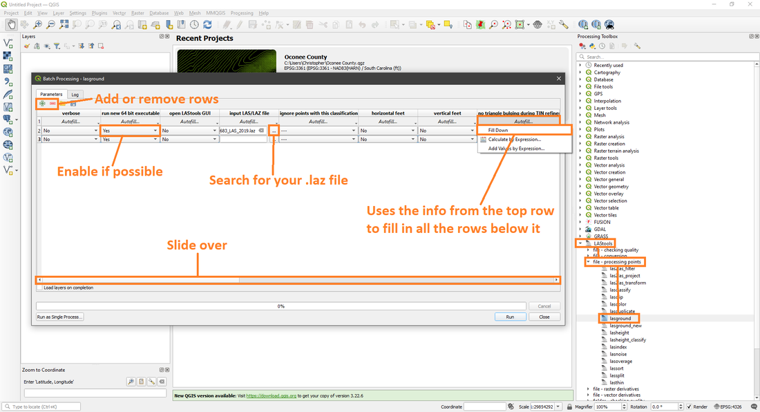
The first process below is lasground, it will classify the LiDAR points into ground points (class 2) and non-ground points (class 1). This makes the end result look better than if we skipped this step.
The first process below is lasground, it will classify the LiDAR points into ground points (class 2) and non-ground points (class 1). This makes the end result look better than if we skipped this step.

Lasground single file process.
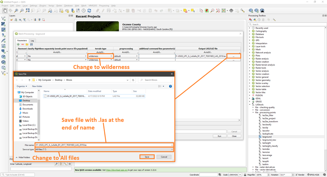
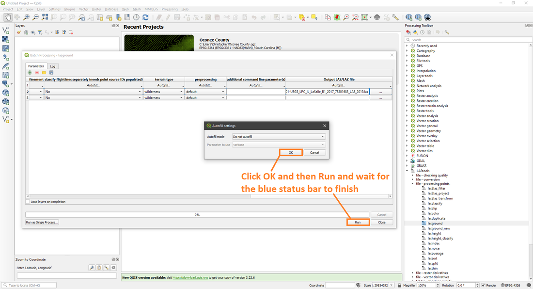
Below is the Batch Process of lasground, it allows you to process a lot of files at once, but keep in mind that the more files you process the longer it will take.
|
|
Lasground batch file process.
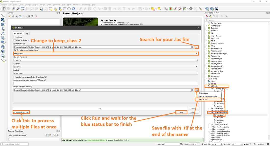
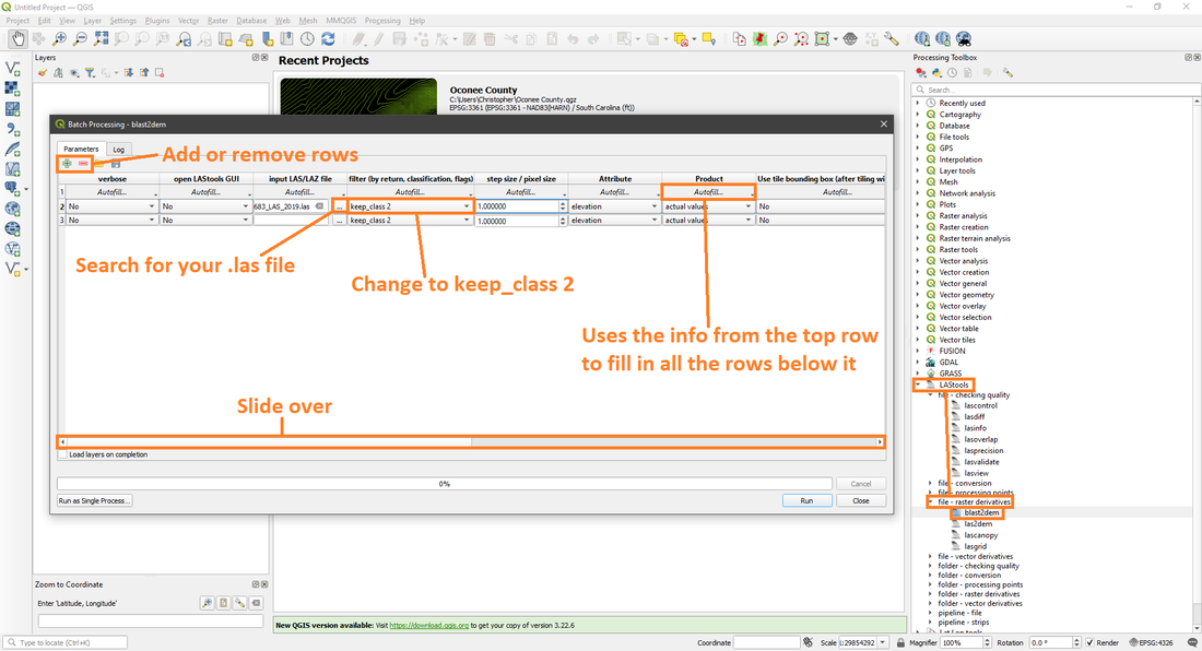
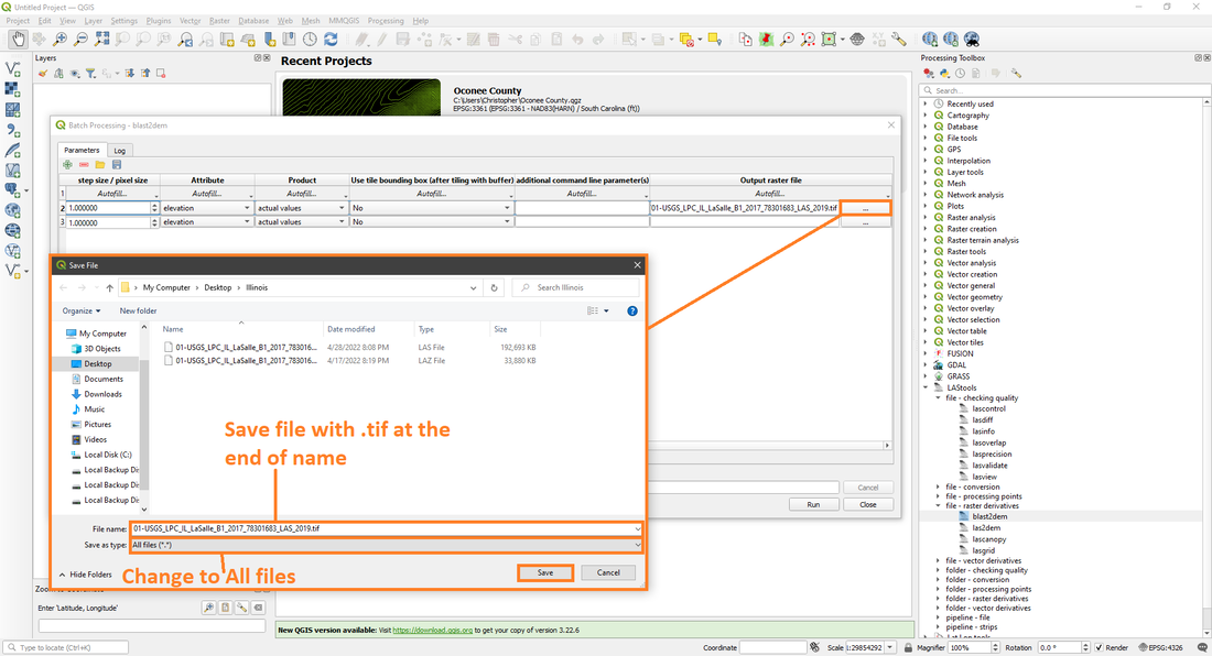
Once the lasground process is completed, you can then move onto the second process which is blast2dem and it works pretty much similarly to lasground.
Blast2dem single file process.
Below is the Batch Process of blast2dem and as with lasground it is pretty much similar again. You can actually process a lot of files at once and not have to wait that long compared to lasground.
|
|

Blast2dem batch file process.
And you've officially processed LiDAR Point Cloud data into DEM data, was it as scary as you thought it would be? The next step is to open and view the data. Link for Opening And Viewing Data.
