Opening And Viewing Data
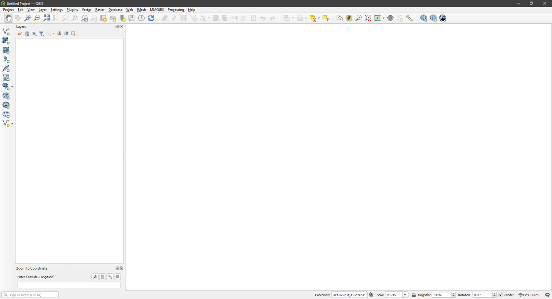
Opening data in QGIS is pretty easy and can be done in just a few clicks. The two tools that you will use are Vector Layers and Raster Layers. They both work pretty similar to each other, but they open different file types. Vector Layers will be your primary tool as it opens almost every file type there is, such as .shp, .gdb, .kml and .gpx to name a few. Raster Layers on the other hand opens a lot of image based file types, such as .tif (DEM data).
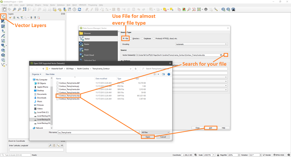
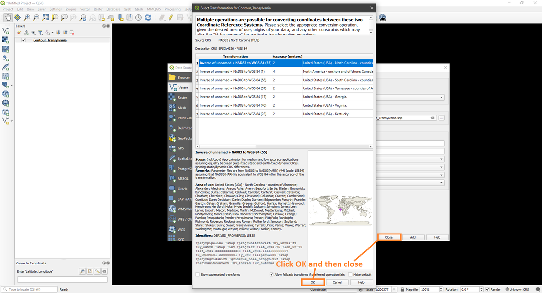
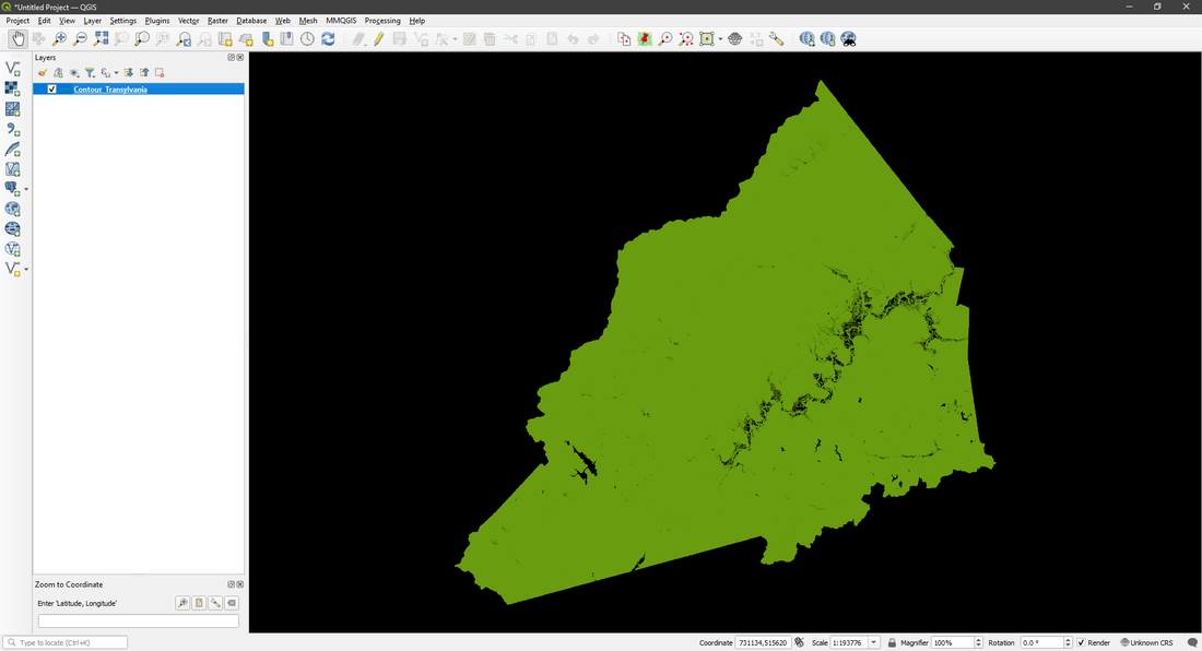
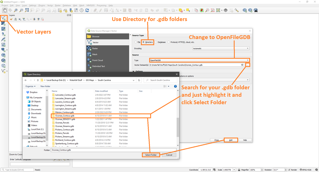
The first tool I'll be showing is Vector Layers. There are actually a few settings that determine the file type you can open, which I'll show in the photos below.
The first tool I'll be showing is Vector Layers. There are actually a few settings that determine the file type you can open, which I'll show in the photos below.
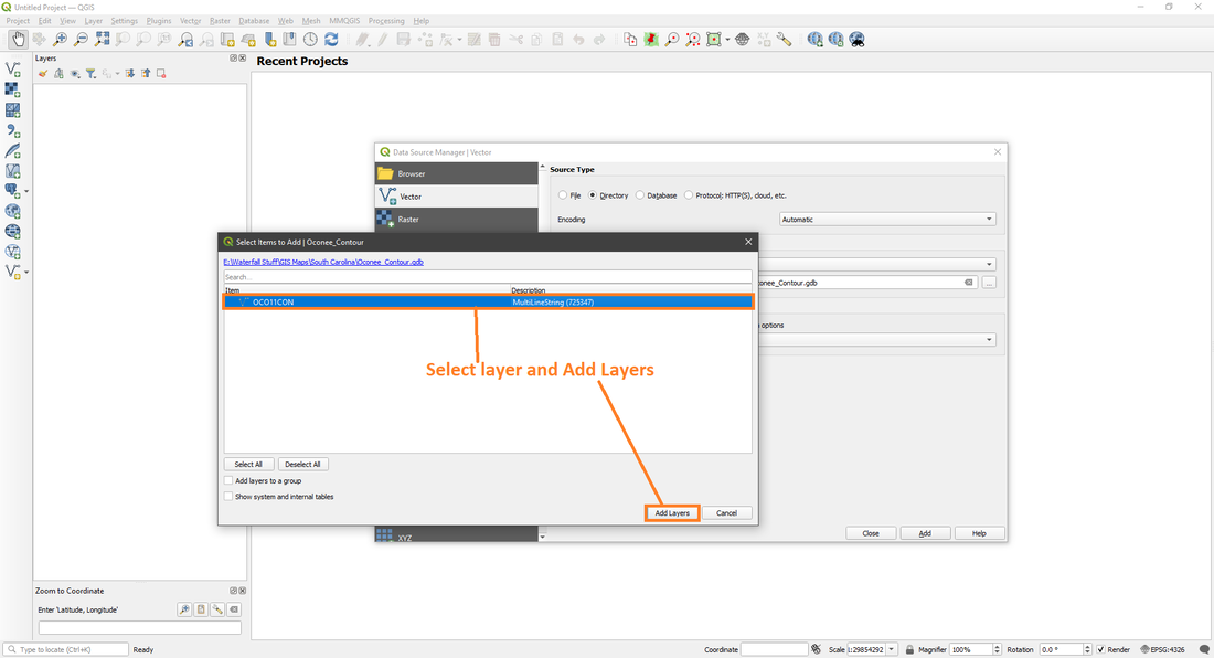
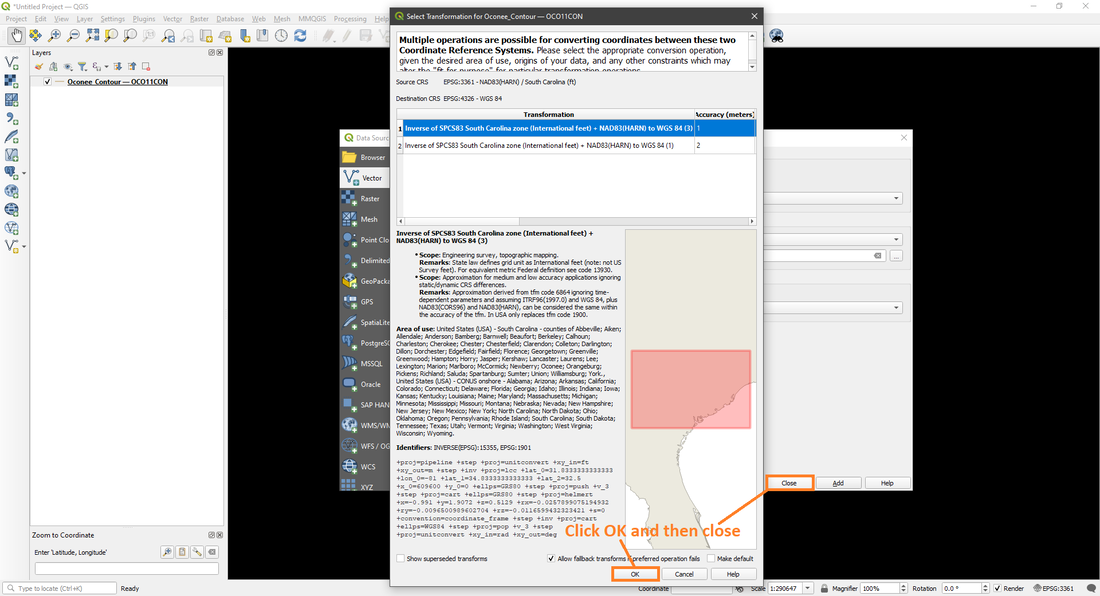
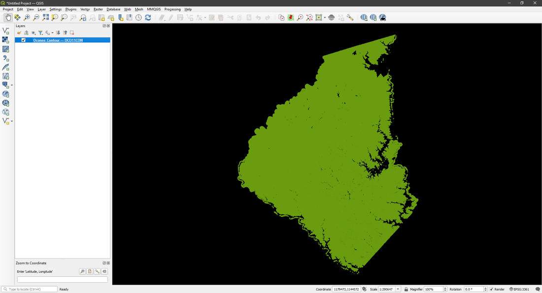
GDB or Geodatabase Folders require a few extra steps to open compared to other Vector Layers, but is still easy.
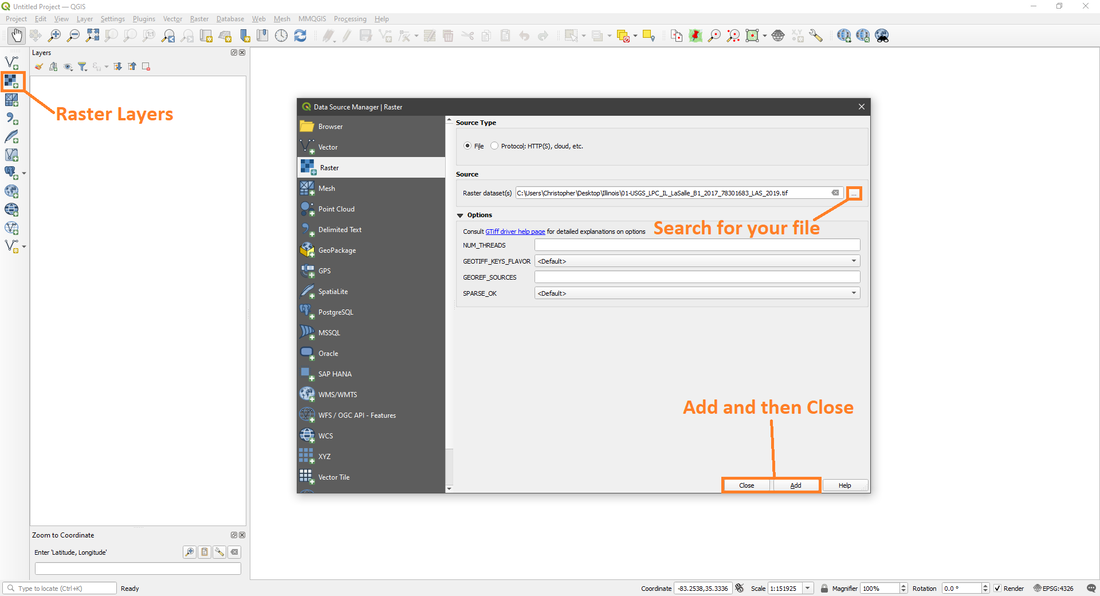
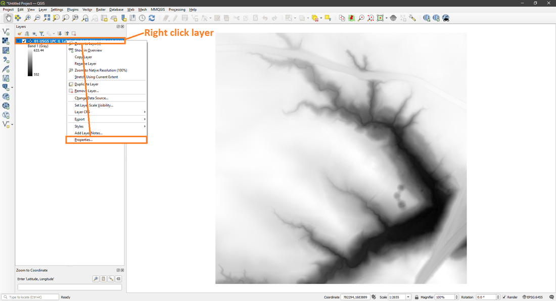
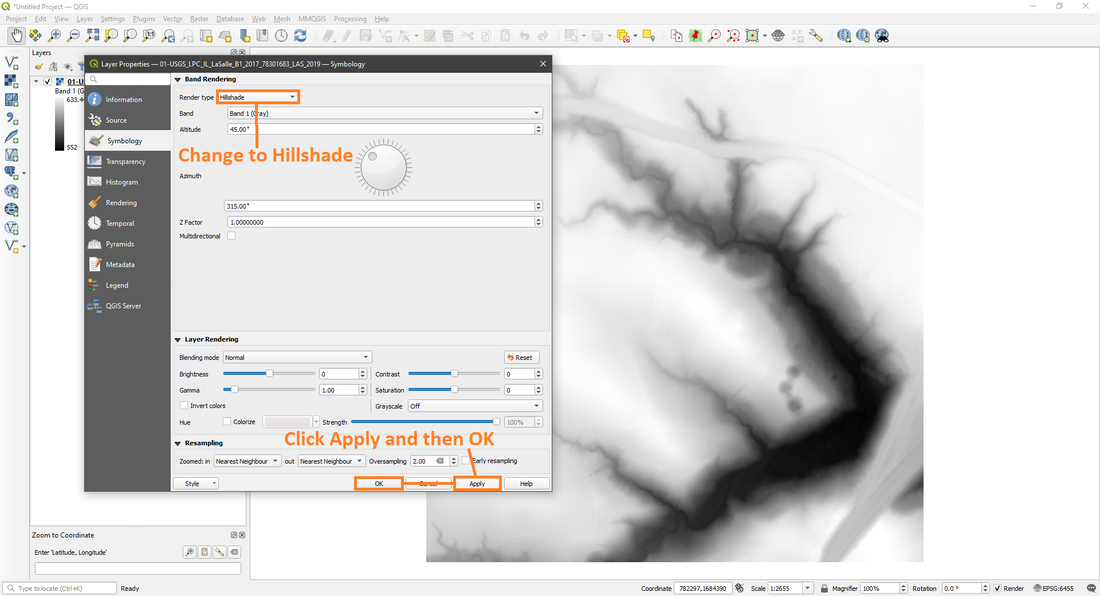
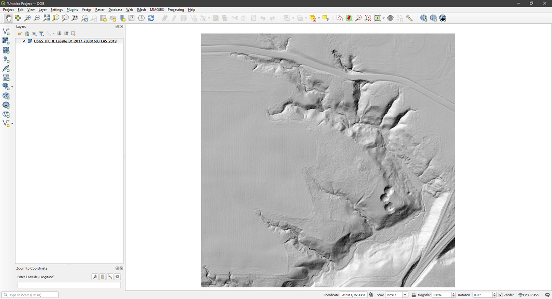
Now I will show you how to open Raster Layers, which is one of the faster layers to open.
For more info on QGIS and for links to other useful GIS data. Links for QGIS Tips & Tricks and Resources.
