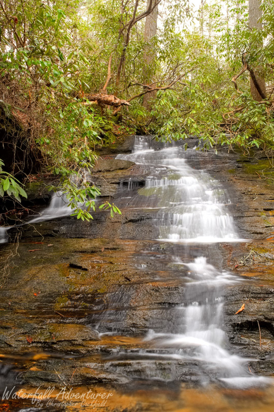
Middle Blueless Falls
- Height: 12 feet
- Type: Cascade
- Stream: Tributary of Long Creek
- River Basin: Savannah River
- Elevation: 1,488 feet
- Landowner: U.S. Department of Agriculture
- Recreational Area: Sumter National Forest, Andrew Pickens Ranger District
- State: South Carolina
- County: Oconee
- USGS Map: Rainy Mountain
- Difficulty: Moderate to strenuous
- Accessibility: Bushwhack
- Trail Blaze: None
- Admission Fee: None
- Hike Length: 0.60 miles
- Waterfall GPS: 34.77474 -83.29637
- Parking GPS: 34.77317 -83.30078
Overview
The four Blueless Falls get their name from there not being any creek lines on any topographic maps.
Driving Directions
From Westminster, South Carolina. From the intersection of US-123, head north on US-76 for 12.9 miles. Turn left on Damascus Church Road. Drive 0.8 miles and turn right on Battlecreek Road. Drive 1.8 miles and turn right onto Turkey Ridge Road. Drive 2 miles and park on the right side of the road, just past a dirt road on the right.
From Clayton, Georgia. From the intersection of US-441, head east on US-76 for 10.7 miles. Turn right on Orchard Road. Drive 2.4 miles and turn right on Battlecreek Road. Drive 1.4 miles and turn right onto Turkey Ridge Road. Drive 2 miles and park on the right side of the road, just past a dirt road on the right.
From Clayton, Georgia. From the intersection of US-441, head east on US-76 for 10.7 miles. Turn right on Orchard Road. Drive 2.4 miles and turn right on Battlecreek Road. Drive 1.4 miles and turn right onto Turkey Ridge Road. Drive 2 miles and park on the right side of the road, just past a dirt road on the right.
Hiking Directions
From the parking. Head down the northeast side of the road into the valley and follow it for 0.25 miles to where the valley is covered in downfall. (You can see Lower Blueless Falls from here.) Head left and bushwhack your way up the hill to get around the downfall, then head towards the creek and head upstream to Lower Blueless Falls. Carefully climb up the left side of the falls (River right.) to the free fall, then climb up the hillside to get up above and around the upper section of Lower Blueless Falls. Once up the hillside, head upstream to the falls.
You could also reach the falls from the logging road that leads to Upper Long Creek Falls.
My GPS track can be found below. Click on the track name to be taken to the Gaia GPS website where you can save the track to your phone or computer.
You could also reach the falls from the logging road that leads to Upper Long Creek Falls.
My GPS track can be found below. Click on the track name to be taken to the Gaia GPS website where you can save the track to your phone or computer.
