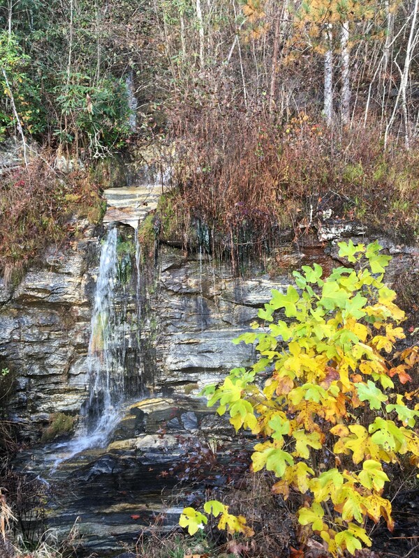
Overlook Falls
- Height: 60 feet
- Type: Cascading free-fall
- Stream: Tributary of Limber Pole Creek
- River Basin: Savannah River
- Elevation: 2,852 feet
- Landowner: U.S. Department of Agriculture
- Recreational Area: Sumter National Forest, Andrew Pickens Ranger District
- State: South Carolina
- County: Oconee
- USGS Map: Cashiers
- Difficulty: Accessible or easy
- Accessibility: Roadside
- Trail Blaze: None
- Admission Fee: None
- Hike Length: 0.2 miles
- Waterfall GPS: 35.00213 -83.04307
- Parking GPS: 35.00092 -83.04368
Overview
Overlook Falls (also known as Wiggington Road Falls) isn't anything to get excited about as it's mainly a very low flow waterfall.
Driving Directions
From Walhalla, South Carolina. From the intersection of SC-183, head west on SC-28 for 8.1 miles and turn right onto SC-107. Drive 14 miles and turn right onto Wigington Road. Drive 0.8 miles and turn right into the Wigington Overlook parking.
From Salem, South Carolina. From the intersection of SC-11, head north on SC-130 for 9.4 miles and turn left on Wigington Road. Drive 1.4 miles and turn left into the Wigington Overlook parking.
From Cashiers, North Carolina. From the intersection of US-64, head south on NC-107 for 8.2 miles to the NC/SC border, where NC-107 turns into SC-107. Continue following SC-107 for 1 mile and turn left onto Wigington Road. Drive 0.8 miles and turn right into the Wigington Overlook parking.
Hiking Directions
From the parking. Head northeast down the road for 500+ feet to the waterfall on the left-side of the road.
You could also park near the waterfall and view it, which is the accessible view.
My GPS track can be found below. Click on the track name to be taken to the Gaia GPS website where you can save the track to your phone or computer.
You could also park near the waterfall and view it, which is the accessible view.
My GPS track can be found below. Click on the track name to be taken to the Gaia GPS website where you can save the track to your phone or computer.
