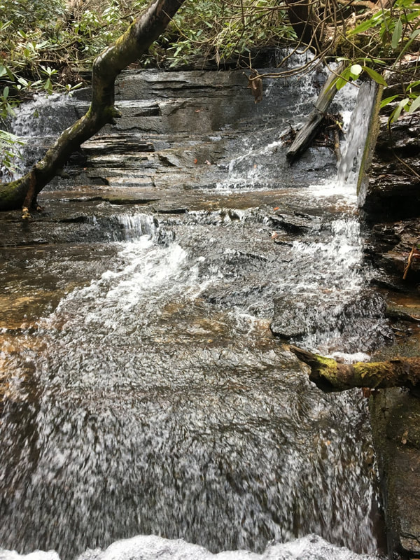
Middle Yellow Branch Falls
- Height: 14 feet
- Type: Cascade
- Stream: Yellow Branch
- River Basin: Savannah River
- Elevation: 1,448 feet
- Landowner: U.S. Department of Agriculture
- Recreational Area: Sumter National Forest, Andrew Pickens Ranger District
- State: South Carolina
- County: Oconee
- USGS Map: Whetstone
- Difficulty: Easy
- Accessibility: Trail & scramble
- Trail Blaze: None
- Admission Fee: None
- Hike Length: 0.44 miles
- Waterfall GPS: 34.80301 -83.12979
- Parking GPS: 34.80579 -83.12864
Overview
Driving Directions
From Walhalla, South Carolina. From the intersection of SC-183, head west on SC-28 for 5.3 miles and turn left onto Yellow Branch Road. Keep left at the fork and drive until it ends into the big parking.
From Cashiers, North Carolina. From the intersection of US-64, head south on NC-107 for 8.2 miles to the NC/SC border, where NC-107 turns into SC-107. Continue following SC-107 for 15 miles and turn left onto SC-28. Drive 2.8 miles and turn right onto Yellow Branch Road. Keep left at the fork and drive until it ends into the big parking.
From Cashiers, North Carolina. From the intersection of US-64, head south on NC-107 for 8.2 miles to the NC/SC border, where NC-107 turns into SC-107. Continue following SC-107 for 15 miles and turn left onto SC-28. Drive 2.8 miles and turn right onto Yellow Branch Road. Keep left at the fork and drive until it ends into the big parking.
Hiking Directions
From the parking. On the south side of the parking is the beginning of the Yellow Branch Falls Trail. Follow the trail for 750+ feet where you'll come to your first creek crossing. Once across continue for 70+ feet and cross the creek again at the base of a nice cascade, 200+ more feet and you'll cross the creek once again. Once across continue following the trail for 80+ feet to a path on the right side of the trail heading down to the creek and falls.
My GPS track can be found below. Click on the track name to be taken to the Gaia GPS website where you can save the track to your phone or computer.
My GPS track can be found below. Click on the track name to be taken to the Gaia GPS website where you can save the track to your phone or computer.
