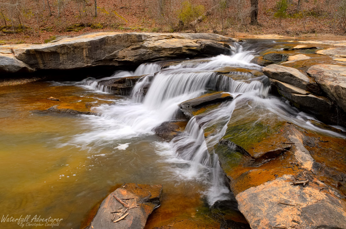
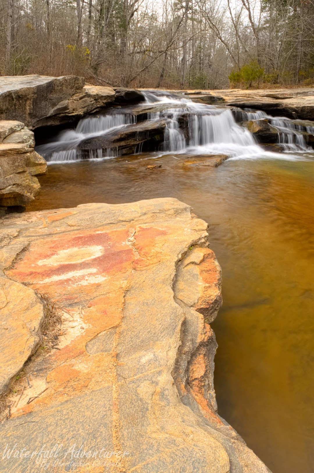
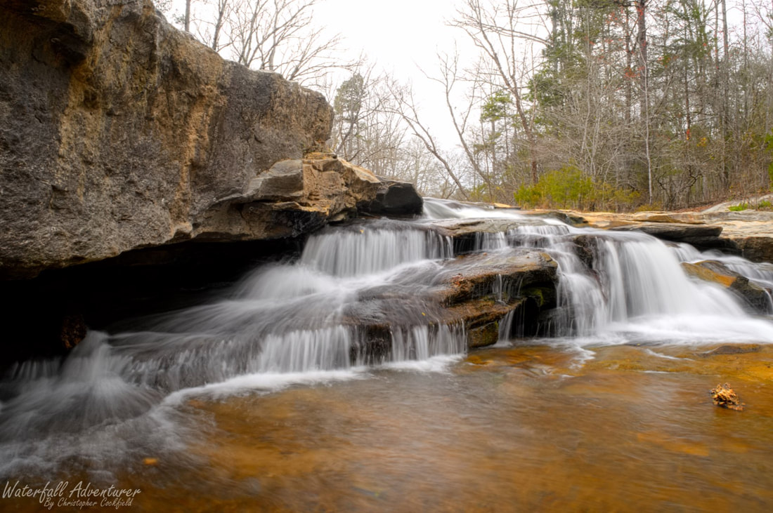
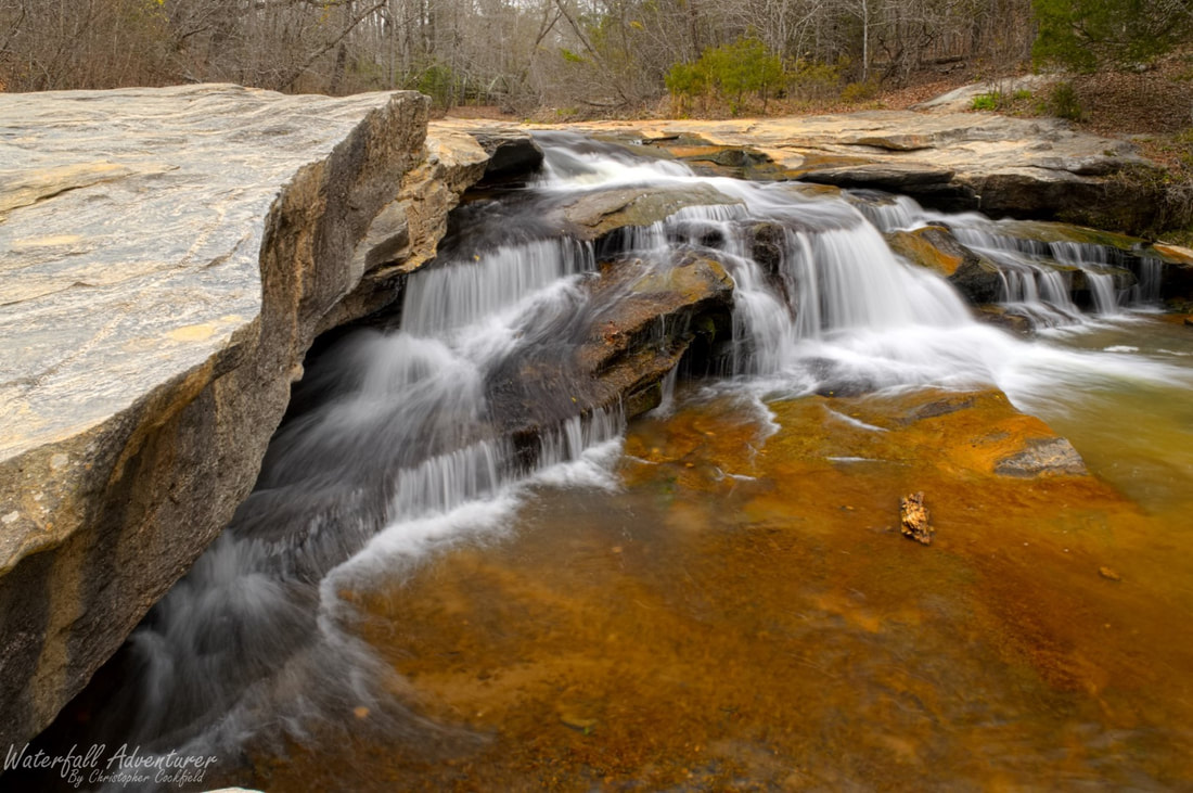
Horseshoe Falls
- Height: 6 feet
- Type: Cascade
- Stream: Cedar Shoals Creek
- River Basin: Santee River
- Elevation: 402 feet
- Landowner: South Carolina Department of Parks, Recreation & Tourism
- Recreational Area: Musgrove Mill State Historic Site
- State: South Carolina
- County: Spartanburg
- USGS Map: Philson Crossroads
- Difficulty: Accessible and easy
- Accessibility: Concrete path and trail
- Trail Blaze: None
- Admission Fee: $3 per adult (16 & older), $1 per child (6 to 15, free admission for children under 6) and $1.50 for South Carolina Residents (65 & older), Disabled South Carolina Residents and South Carolina National Guard Members.
- Hike Length: 0.2 miles
- Waterfall GPS: 34.596438 -81.854292
- Parking GPS: 34.596867 -81.855791
Overview
Horseshoe Falls is also known as Gordons Mill Falls.
Driving Directions
From Clinton, South Carolina. From the intersection of US-76, head north on North Broad Street (SC-56) for 0.5 miles and keep right at the fork onto Willard Road (SC-56). Drive 0.4 miles and turn left onto SC-6 Business. Drive 9.9 miles and turn left onto Horseshoe Falls Road. Drive 1.4 miles and turn right into the parking, before the bridge.
From Woodruff, South Carolina. From the intersection of US-221, head east on Cross Anchor Road (SC-146) for 12.1 miles and merge onto SC-56. Drive for 2.2 miles and turn right onto Horseshoe Falls Road. Drive 1.4 miles and turn right into the parking, before the bridge.
From Union, South Carolina. From the intersection of US-176 Bypass, head west on Main Street (SC-49) for 18.7 miles and turn left onto SC-56. Drive 1.9 miles and turn right onto Horseshoe Falls Road. Drive 1.4 miles and turn right into the parking, before the bridge.
There are two accessible parking spots at the trailhead on the left-side of the road, before the bridge.
Hiking Directions
From the parking. Cross the road, heading towards the accessible parking spots and follow the concrete path for 500+ feet to a overlook for the waterfall. To reach the base of the waterfall, take a short dirt path from the overlook to the creek.
My GPS track can be found below. Click on the track name to be taken to the Gaia GPS website where you can save the track to your phone or computer.
My GPS track can be found below. Click on the track name to be taken to the Gaia GPS website where you can save the track to your phone or computer.
|
|
