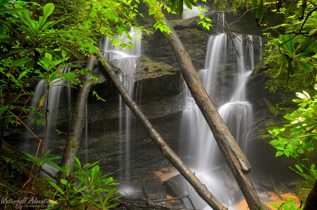
Tumbling Falls
- Height: 24 feet
- Type: Cascading free-fall
- Stream: Turpin Branch
- River Basin: Savannah River
- Elevation: 1,512 feet
- Landowner: U.S. Department of Agriculture
- Recreational Area: Sumter National Forest, Andrew Pickens Ranger District
- State: South Carolina
- County: Oconee
- USGS Map: Rainy Mountain
- Difficulty: Moderate
- Accessibility: Bushwhack
- Trail Blaze: None
- Admission Fee: None
- Hike Length: 0.28 miles
- Waterfall GPS: 34.83936 -83.26095
- Parking GPS: 34.84003 -83.25898
Overview
Tumbling Falls is an amazing discovery of mine, that tumbles across ledges and creates a misty ozone climate at the base of the waterfall.
Driving Directions
From Walhalla, South Carolina. From the intersection of SC-183, head west on SC-28 for 6.1 miles and turn left onto Whetstone Road. Drive 4.9 miles and turn left onto Chattooga Ridge Road. Drive 3.8 miles and turn right onto Fall Creek Road. Drive 0.3 miles and turn left to stay on Fall Creek Road. Drive 2.3 miles and continue left onto Turpin Branch Road. Drive 0.5 miles and park on the left side of the road in a small grassy area.
From Westminster, South Carolina. From the intersection of US-123, head north on US-76 for 15.4 miles and turn right onto Chattooga Ridge Road. Drive 2.1 miles and turn left onto Fall Creek Road. Drive 0.3 miles and turn left to stay on Fall Creek Road. Drive 2.3 miles and continue left onto Turpin Branch Road. Drive 0.5 miles and park on the left side of the road in a small grassy area.
From Clayton, Georgia. From the intersection of US-441, head east on US-76 for 10.3 miles and turn left onto Chattooga Ridge Road. Drive 2.1 miles and turn left onto Fall Creek Road. Drive 0.3 miles and turn left to stay on Fall Creek Road. Drive 2.3 miles and continue left onto Turpin Branch Road. Drive 0.5 miles and park on the left side of the road in a small grassy area.
Hiking Directions
From the parking. Head west for 160+ feet, and than follow the valley down to the creek and falls for 550+ feet.
My GPS track can be found below. Click on the track name to be taken to the Gaia GPS website where you can save the track to your phone or computer.
My GPS track can be found below. Click on the track name to be taken to the Gaia GPS website where you can save the track to your phone or computer.
