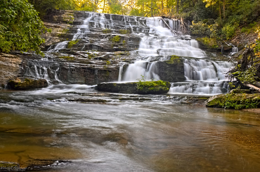
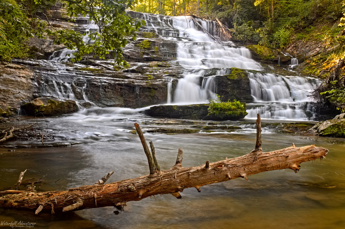
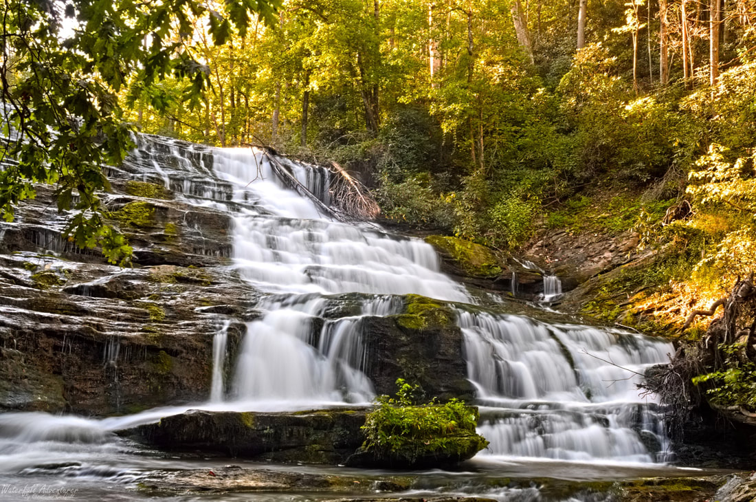
Upper Brasstown Falls
- Height: 54 feet
- Type: Cascading staircase
- Stream: Brasstown Creek
- River Basin: Savannah River
- Elevation: 1,020 feet
- Landowner: United States Department of Agriculture
- Recreational Area: Sumter National Forest, Andrew Pickens Ranger District
- State: South Carolina
- County: Oconee
- USGS Map: Tugaloo Lake
- Difficulty: Easy
- Accessibility: Trail
- Trail Blaze: None
- Admission Fee: None
- Hike Length: 0.35 miles
- Waterfall GPS: 34.71837 -83.30411
- Parking GPS: 34.71916 -83.30173
Overview
Upper Brasstown Falls is also known as Brasstown Cascades.
Driving Directions
From Westminster, South Carolina. From the intersection of US-123, head north on US-76 for 11.7 miles and turn left onto Brasstown Road. Drive 4 miles and turn right onto Brasstown Falls Road, right before the bridge. Drive for 0.5 mile to where the road dead ends and park.
From Clayton, Georgia. From the intersection of US-441, head east on US-76 for 13.9 miles and turn right onto Brasstown Road. Drive 4 miles and turn right onto Brasstown Falls Road, right before the bridge. Drive for 0.5 mile to where the road dead ends and park.
From Clayton, Georgia. From the intersection of US-441, head east on US-76 for 13.9 miles and turn right onto Brasstown Road. Drive 4 miles and turn right onto Brasstown Falls Road, right before the bridge. Drive for 0.5 mile to where the road dead ends and park.
Hiking Directions
From the parking. Head between the boulders at the end of the parking and follow the trail for 480+ feet to a split in the trail and head right. Continue following the trail for 325+ feet to stairs heading down to a platform overlooking the waterfall.
My GPS track can be found below. Click on the track name to be taken to the Gaia GPS website where you can save the track to your phone or computer.
My GPS track can be found below. Click on the track name to be taken to the Gaia GPS website where you can save the track to your phone or computer.
|
|
