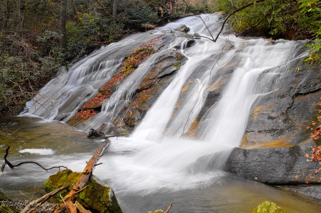
Shiver Me Timber Falls
- Height: 36 feet
- Type: Steep sliding cascade
- Stream: Limber Pole Creek
- River Basin: Savannah River
- Elevation: 1,440 feet
- Landowner: Duke Venture Real Estate LLC
- Recreational Area: Sumter National Forest, Andrew Pickens Ranger District
- State: South Carolina
- County: Oconee
- USGS Map: Tamassee
- Difficulty: Very strenuous
- Accessibility: Forest road, bushwhack & creek walking
- Trail Blaze: None
- Admission Fee: None
- Hike Length: 2.4+ miles
- Waterfall GPS: 34.98653 -83.01180
- Parking GPS: 34.98639 -83.02747
Overview
Shiver Me Timber Falls is one of the hardest hikes in Oconee County.
Driving Directions
From Walhalla, South Carolina. From the intersection of SC-28, head north on SC-183 for 3.5 miles and turn left onto Christophers Road. Drive 0.1 miles and turn right onto SC-11. Drive 8.7 miles and turn left onto SC-130. Drive 7.3 miles and park on the right side of the road near a old forest road.
From Cashiers, North Carolina. From the intersection of US-64, head south on NC-107 for 8.2 miles to the NC/SC border, where NC-107 turns into SC-107. Continue following SC-107 for 1 mile and turn left onto Wigington Road. Drive 2.2 miles and turn right onto SC-130. Drive 2.1 miles and park on the left side of the road near a old forest road.
From Cashiers, North Carolina. From the intersection of US-64, head south on NC-107 for 8.2 miles to the NC/SC border, where NC-107 turns into SC-107. Continue following SC-107 for 1 mile and turn left onto Wigington Road. Drive 2.2 miles and turn right onto SC-130. Drive 2.1 miles and park on the left side of the road near a old forest road.
Hiking Directions
From the parking. There's no easy way to reach the falls, but it's best to follow the old forest road to a point where you can head east towards the falls. You'll have a lot of obstacles to deal with as you make your way towards the falls
I would highly recommend downloading my GPS track and following the southern side of my track, as it's the less dangerous option.
My GPS track can be found below. Click on the track name to be taken to the Gaia GPS website where you can save the track to your phone or computer.
I would highly recommend downloading my GPS track and following the southern side of my track, as it's the less dangerous option.
My GPS track can be found below. Click on the track name to be taken to the Gaia GPS website where you can save the track to your phone or computer.
