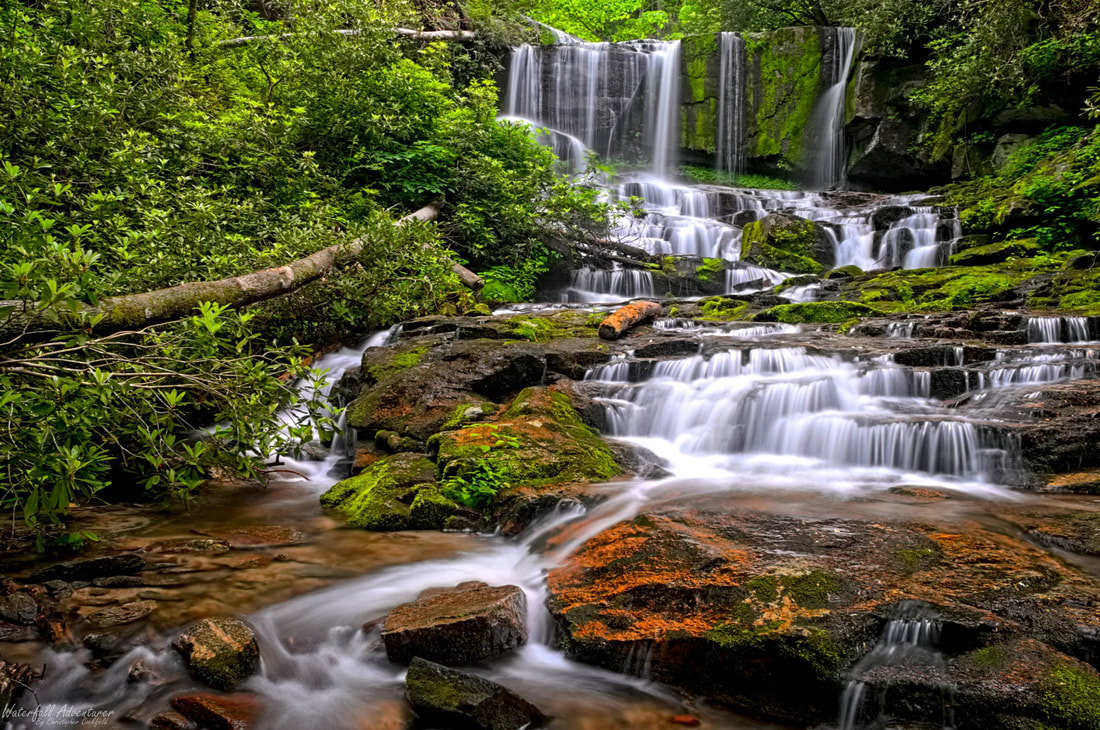
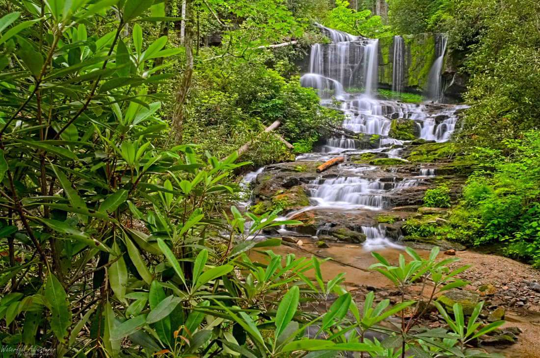
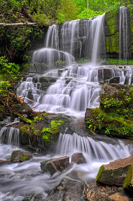
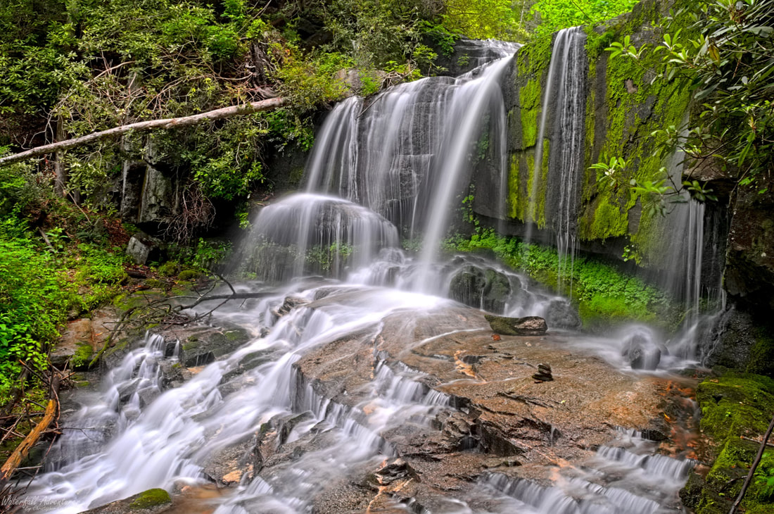
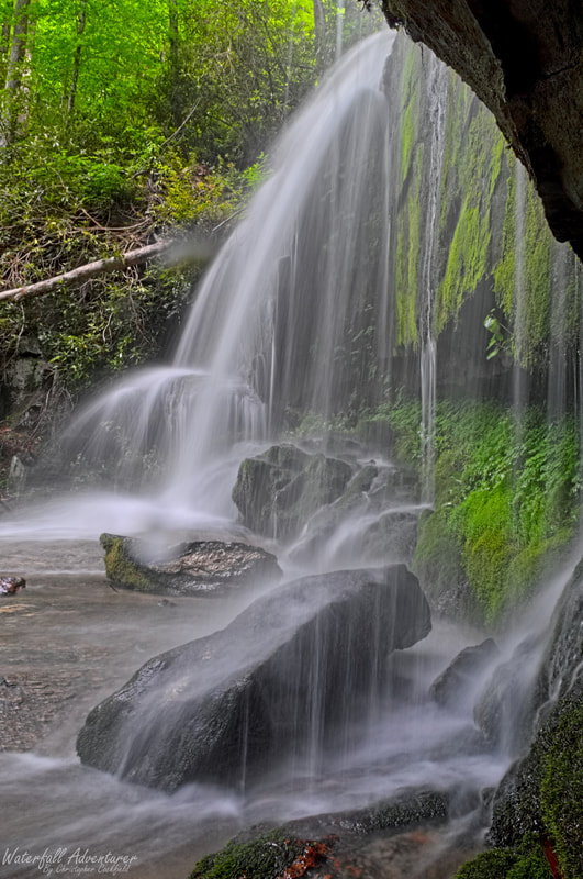
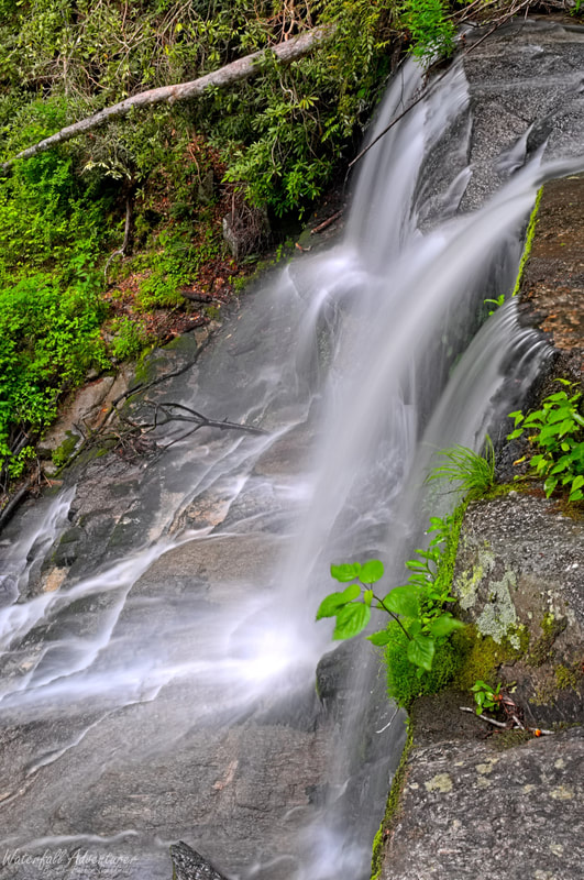
Virginia Hawkins Falls
- Height: 58 feet
- Type: Multi-level, cascading free-fall, main free-fall into double cascade
- Stream: Laurel Fork Creek
- River Basin: Savannah River
- Elevation: 1,784 feet
- Landowner: South Carolina Department of Natural Resources
- Recreational Area: Laurel Fork Heritage Preserve
- State: South Carolina
- County: Pickens
- USGS Map: Eastatoe Gap
- Difficulty: Easy
- Accessibility: Road & trail
- Trail Blaze: White for the Foothills Trail
- Admission Fee: None
- Hike Length: 2.5 miles
- Waterfall GPS: 35.04301 -82.85093
- Parking GPS: 35.04400 -82.83817
Overview
Virginia Hawkins Falls was originally known as Double Falls, but was renamed in December 18, 2004, when the Foothills Trail Conference changed the name to Virginia Hawkins, a longtime executive secretary of the Foothills Trail Conference.
Driving Directions
From Pickens, South Carolina. From the intersection of SC-183, head northwest on US-178 for 16.7 miles and turn left onto Laurel Valley Road, just after the bridge. Keeping right at the fork, drive 3.6 miles on Horse Pasture Road to Laurel Fork Gap and park on the left-side of the road in a small parking space near the intersection of Horse Pasture Road and Canebrake Road.
From Rosman, North Carolina. From city center, head southwest on US-178 for 8.4 miles and turn right onto Laurel Valley Road, just before the bridge. Keeping right at the fork, drive 3.6 miles on Horse Pasture Road to Laurel Fork Gap and park on the left-side of the road in a small parking space near the intersection of Horse Pasture Road and Canebrake Road.
Low clearance vehicles will have a hard time on the Horse Pasture Road!
Hiking Directions
From the parking. On the west side of the road, between the Horse Pasture Road and Canebrake Road is a map of Laurel Creek Heritage Preserve and a spur trail to the Foothills Trail. Follow the spur trail behind the map for 260+ feet to a road and head right. Follow the road for over a mile to a trail sign for Virginia Hawkins Falls on the right. (You'll have several creek crossings on your way.) Head right and follow the trail through a campsite to two bridges and follow the trail to the upstream bridge. (The downstream bridge will take you to Laurel Fork Falls.) Once across the bridge, follow the trail upstream for 450+ feet to the waterfall on the right.
My GPS track can be found below. Click on the track name to be taken to the Gaia GPS website where you can save the track to your phone or computer.
My GPS track can be found below. Click on the track name to be taken to the Gaia GPS website where you can save the track to your phone or computer.
Upper cascading free-fall
|
|
Waterfalls Nearby
- Abbey Falls
- Bella Falls
- Big Cliff Falls
- Bonita Falls
- Bushwhack Falls
- Christopher Falls
- Creekside Falls
- Evil Ducky Falls
- Hidden Veil Falls
- Laurel Fork Falls
- Louie Falls
- Lower Doghobble Hell Falls
- Middle Doghobble Hell Falls
- Upper Laurel Fork Falls
