Where To Download LiDAR Data
Downloading LiDAR data is pretty straightforward and surprisingly free, well almost free, hard drives do cost money and you might need a new one to try and hold a lot of data like I try to do. Your typical LiDAR data that you can download will be Shapefile (.shp), Geodatabase (.gdb) and Digital Elevation Model (.tif), these are already processed files that you can just open and view right away. There is also LiDAR Point Cloud (.laz), but it has to be processed to easily view it, you could technically open it as is, but it looks way better processed. There are other file types that LiDAR can be stored in, but I've only dealt with these so far.
Not every state has a dedicated website for GIS data or even has LiDAR data at all, but North Carolina (NC OneMap) and South Carolina (SCDNR) both have websites that provide all kinds of GIS and LiDAR data that you can download. USGS provides GIS data for most of the United States and is one of the only places that I know of with easily accessible LiDAR Point Cloud data that you can download. Links for NC OneMap, SCDNR and USGS.
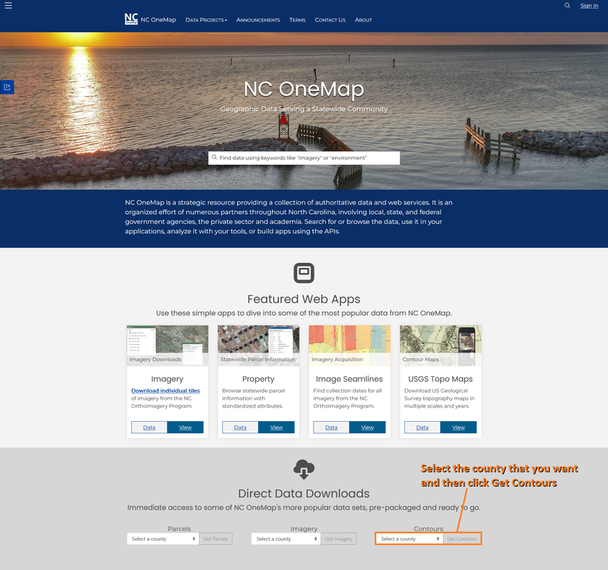
Down below I will direct you to where you need to go to download the LiDAR data. The first one is NC OneMap, which is the easiest to download data from.
Not every state has a dedicated website for GIS data or even has LiDAR data at all, but North Carolina (NC OneMap) and South Carolina (SCDNR) both have websites that provide all kinds of GIS and LiDAR data that you can download. USGS provides GIS data for most of the United States and is one of the only places that I know of with easily accessible LiDAR Point Cloud data that you can download. Links for NC OneMap, SCDNR and USGS.
Down below I will direct you to where you need to go to download the LiDAR data. The first one is NC OneMap, which is the easiest to download data from.
NC OneMap is also one of the best places to view and download property parcel information for the state.
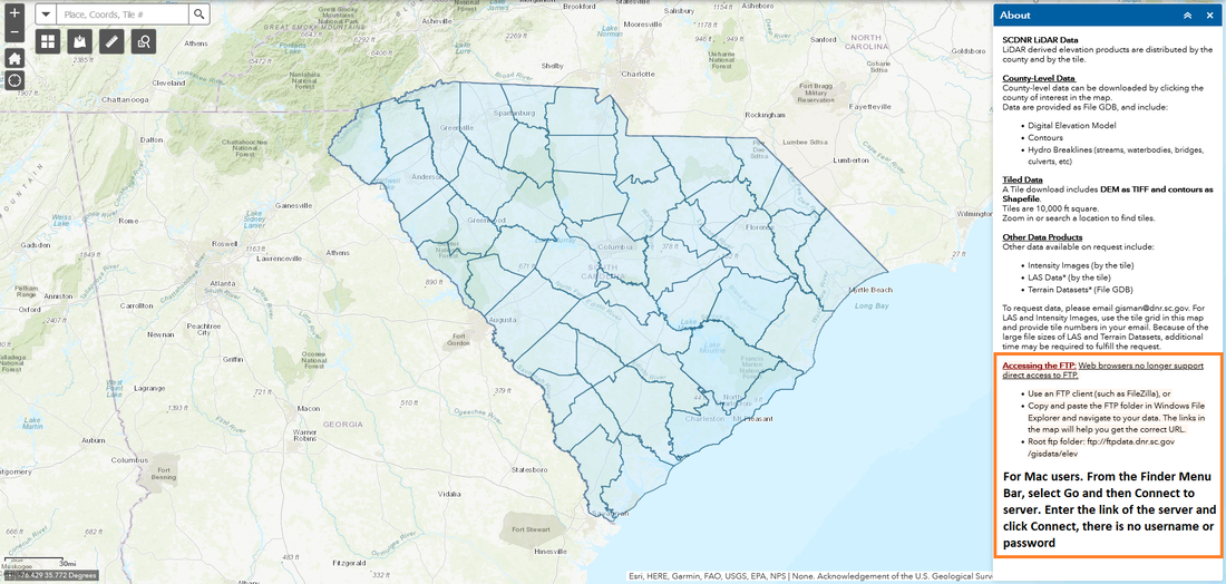
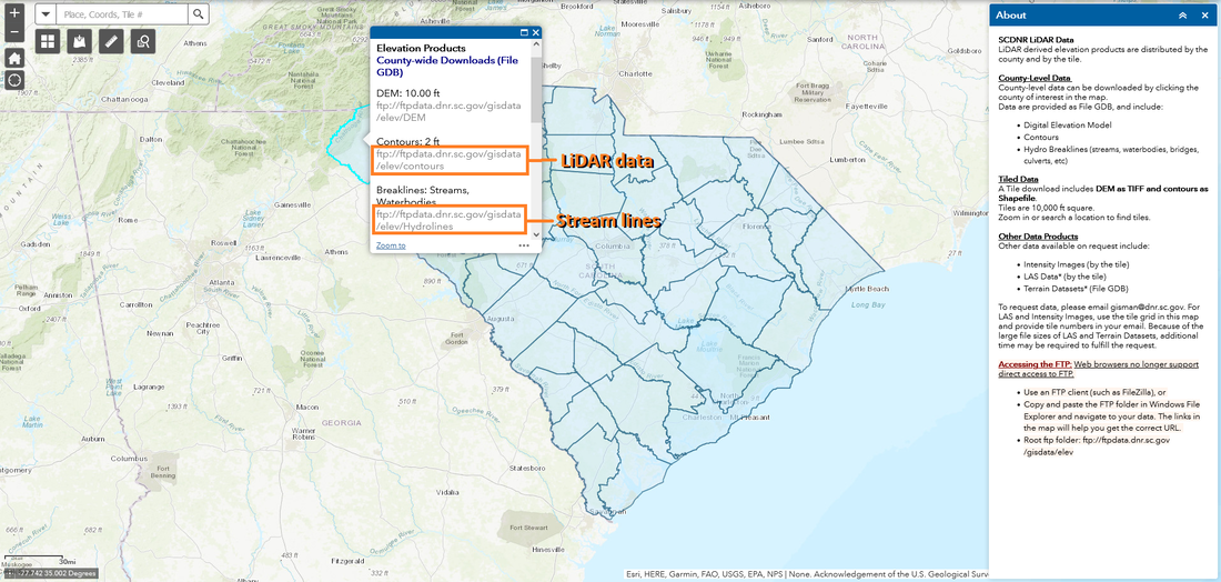
The next one is SCDNR. You will have a few extra steps to deal with, but it's still easy.

|
|
SCDNR has more GIS data, but you will need an account with them to access it.
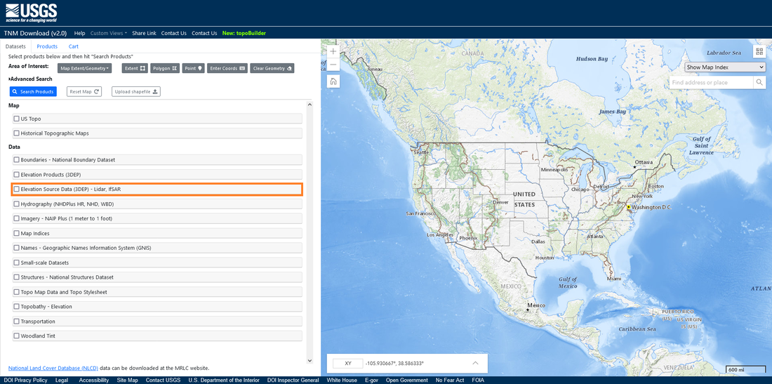
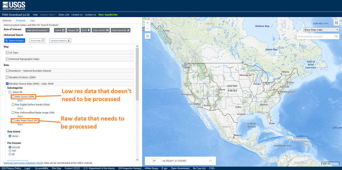
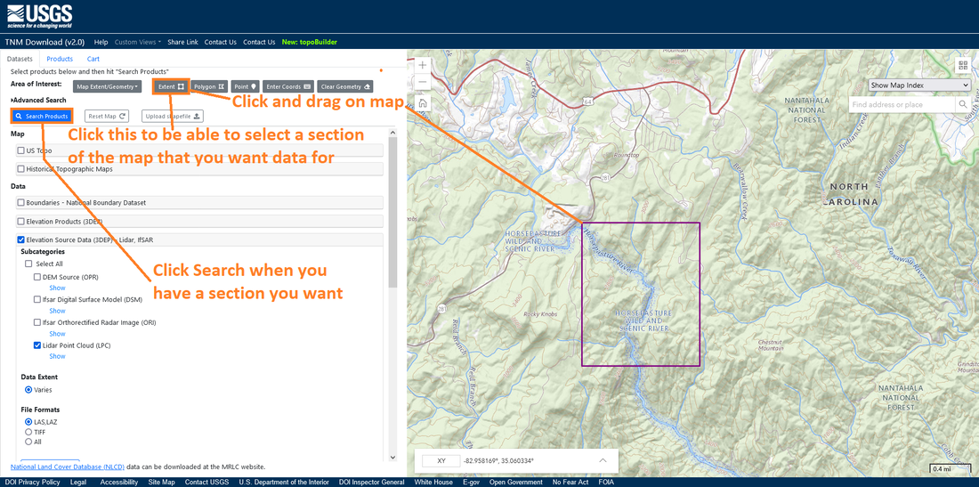
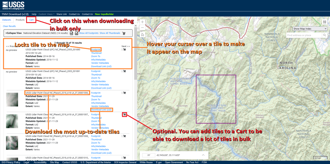
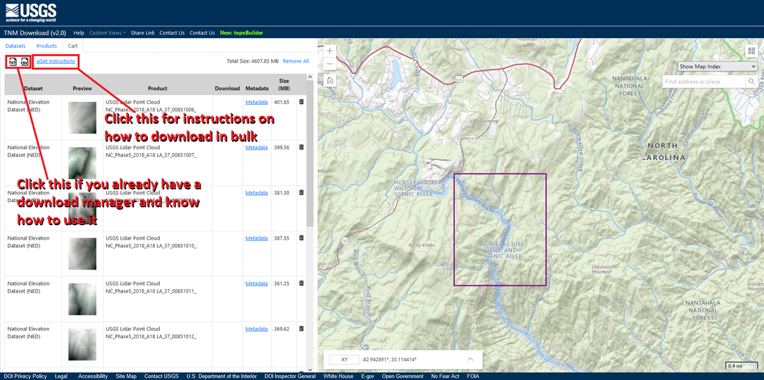
And finally we have USGS. This one has the most steps of the three, but it really isn't that complicated.
|
|
|
|
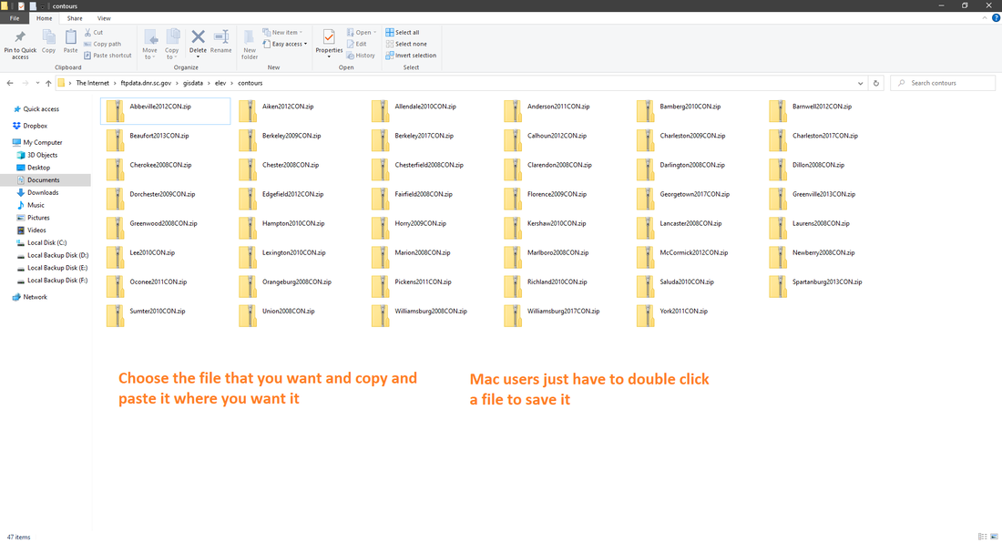
USGS files don't need it, but NC OneMap and SCDNR files are compressed into a zip file and will need to be unzipped to use them, I use 7-Zip. Mac users get to skip this step as their files automatically get unzipped when saving them.
And there you have it, you now know where and how to download LiDAR data. The next steps for you is to either process the LiDAR Point Cloud data that you downloaded, or open and view the data you downloaded. Links for Processing LiDAR Point Cloud Data and Opening And Viewing Data.
And there you have it, you now know where and how to download LiDAR data. The next steps for you is to either process the LiDAR Point Cloud data that you downloaded, or open and view the data you downloaded. Links for Processing LiDAR Point Cloud Data and Opening And Viewing Data.
