Big Bad LiDAR
LiDAR (or Light Detection and Ranging) is extremely useful for finding waterfalls or really any geological thing, be it the true highest point of a mountain, arches, sinkholes, cliffs, hidden buildings, old forgotten roads, mining tracks, trails and of course waterfalls. LiDAR comes in many different forms with the most advanced being a complete 3D map of an area.
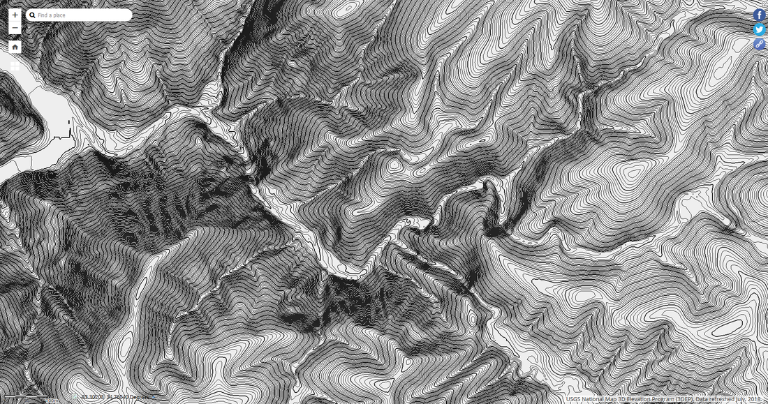
The main forms of LiDAR are hillshade and contour lines, which are pictured below. Compared to topographic maps, LiDAR can obtain detailed 1 foot contour lines or greater, versus topographic maps which normally only have 20 foot contour lines at best, so as you can see LiDAR is very good for finding waterfalls, almost too good, which some people do consider it cheating!
I have created how to guides on The National Map and QGIS that takes you step by step on what you need to do, so you can easily get them up and running for yourself. The images below are from USGS National Map, which is the easiest way of viewing LiDAR data, but the data is of lower quality compared to the data further down the page.
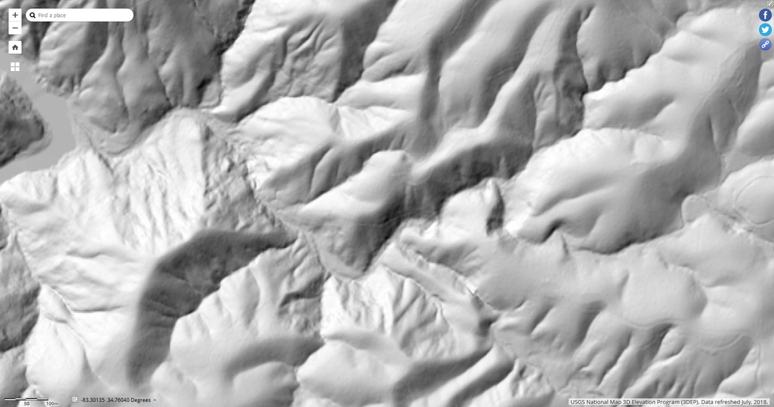
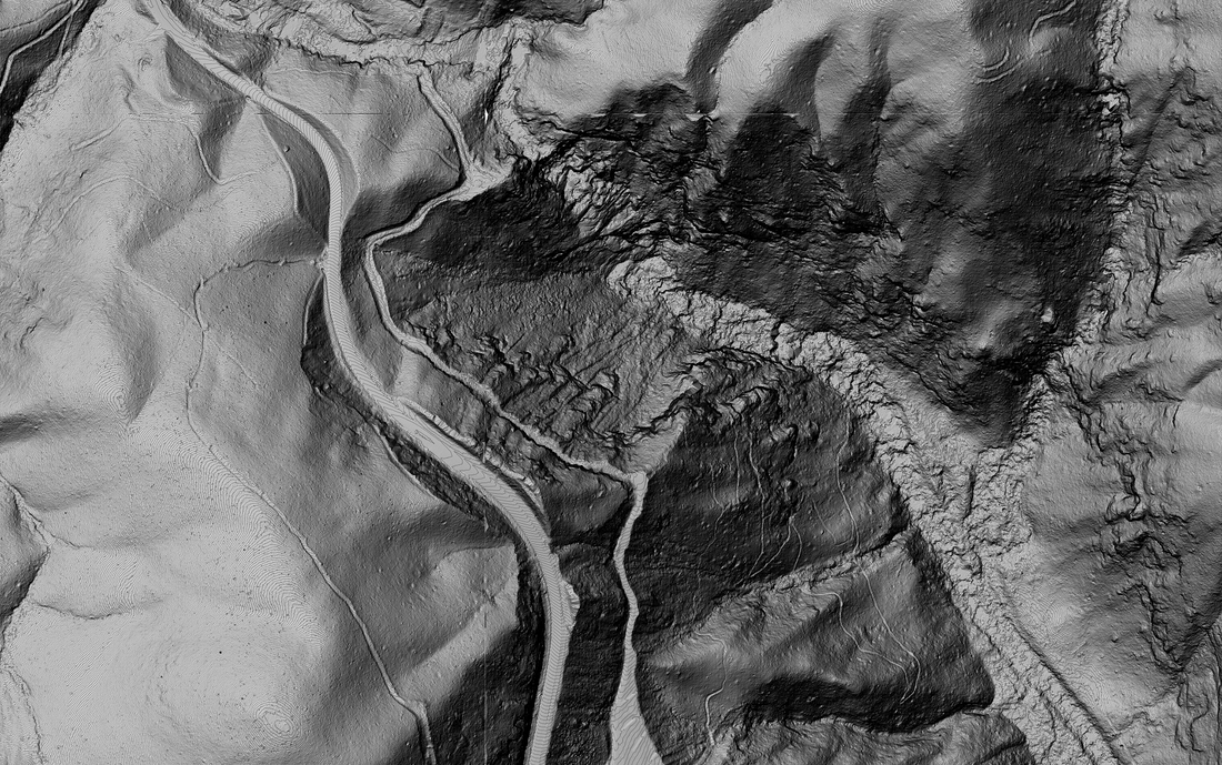
Hillshade (with no contour lines)
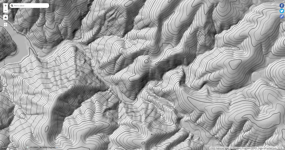
Hillshade (with 30 foot contour lines)
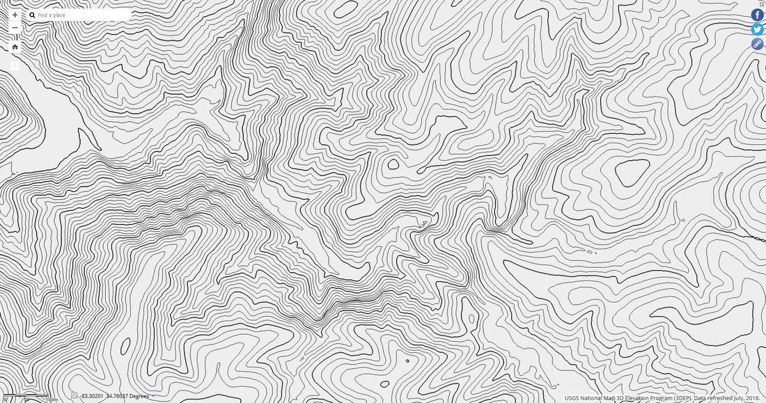
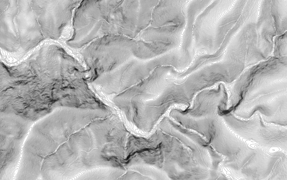
30 foot contour lines (with no hillshade)
|
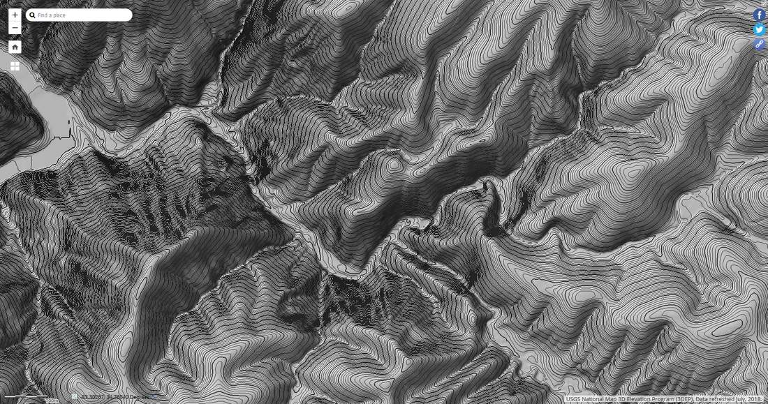
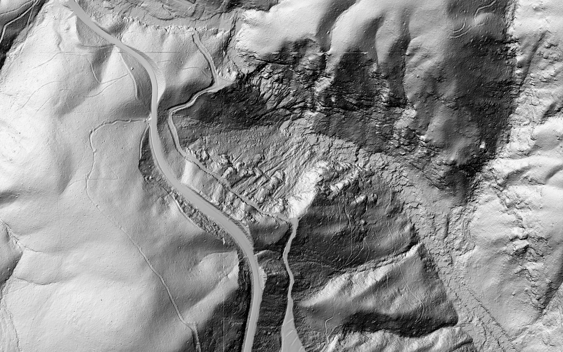
Hillshade (with 3 foot contour lines)
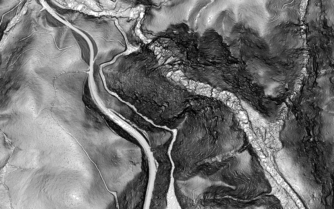
3 foot contour lines (with no hillshade)
|
The maps above are good, but I prefer downloadable data as it's more detailed and you have more control over the data. Down below is LiDAR data downloaded from South Carolina Department of Natural Resources and further down is LiDAR data that I processed from raw LiDAR data from USGS, which yields extremely accurate hillshade and contour data.
2 foot contour lines (with no hillshade)
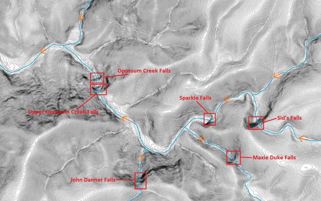
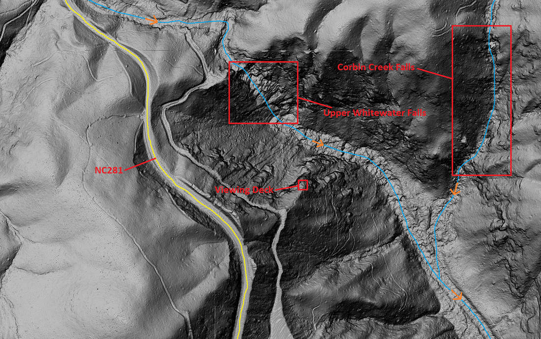
All the images above have been of the Opossum Creek Falls area in Oconee County, South Carolina. The next three images are of the Upper Whitewater Falls area in Transylvania/Jackson County, North Carolina.
Hillshade (with no contour lines)
|
1 foot contours (with no hillshade)
|
Hillshade (with 1 foot contour lines)
The best way to learn how to find waterfalls is by looking at known waterfalls, especially ones that you've been to, so you can then start exploring the map to find more waterfalls, because there's still a lot of waterfalls out there to be rediscovered.
2 foot contour lines and topographic information (with no hillshade)
|
Hillshade (with 1 foot contour lines and topographic information)
|
There are times where LiDAR isn't very accurate and it throws false info, for instance I've seen a 40 foot waterfall not appear at all and I've also seen it show a waterfall, but go field check it and there be nothing at all. It also has trouble at times with narrow places such as slot canyons. It ultimately comes down to the quality of the data, in the end it is still better than a topographic map.
