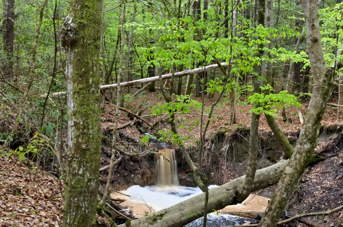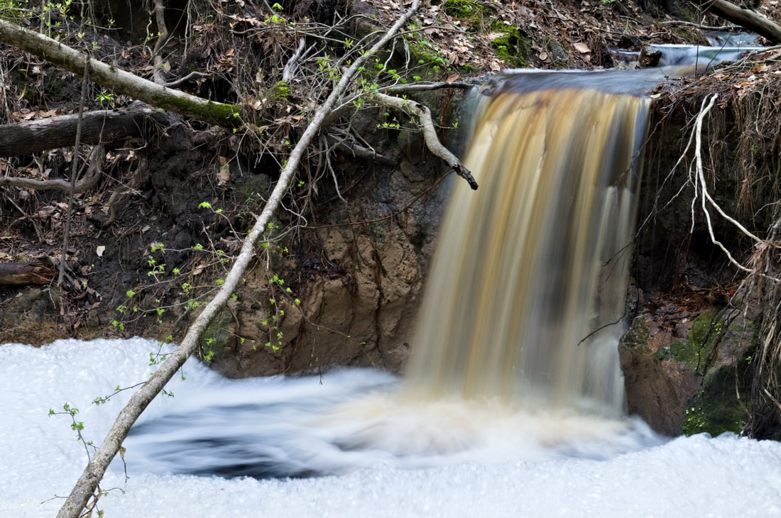
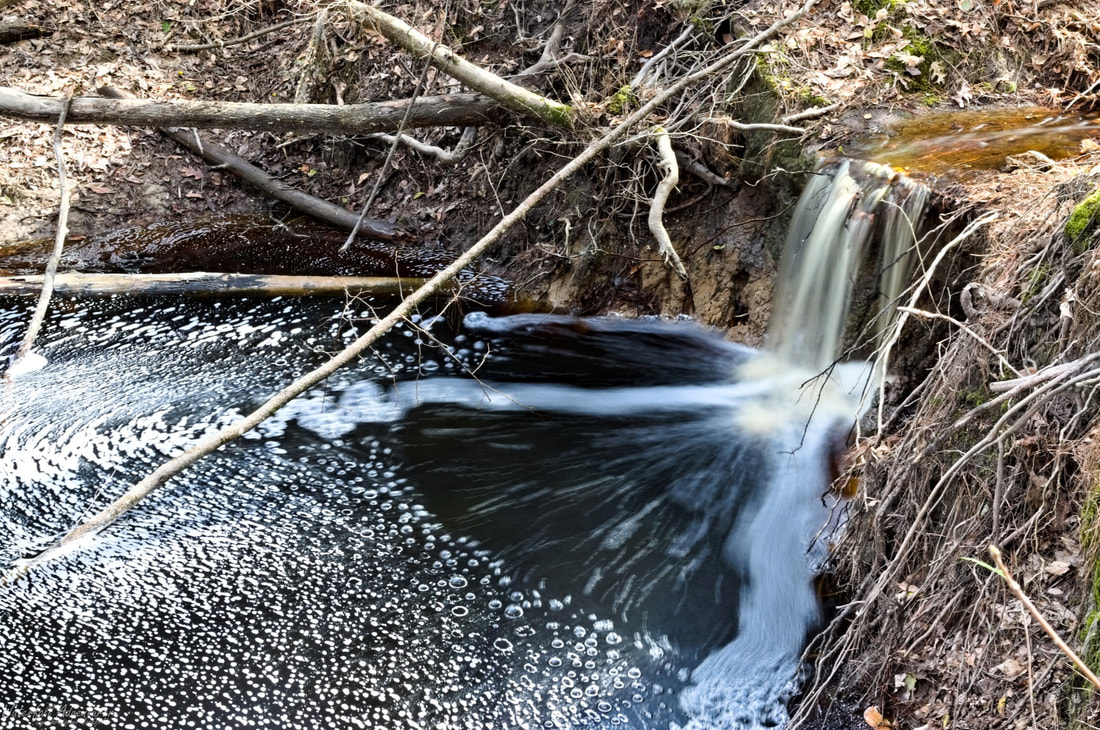
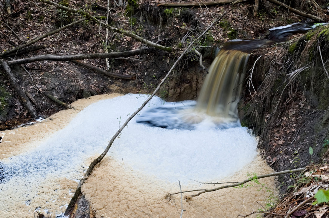
Punchbowl Falls
- Height: 6 feet
- Type: Plunge
- Stream: Tributary of Great Pee Dee River
- River Basin: Great Pee Dee River
- Elevation: 34 feet
- Landowner: South Carolina Public Service Authority
- Recreational Area:
- State: South Carolina
- County: Florence
- USGS Map: Gresham
- Difficulty: Easy to moderate
- Accessibility: Forest road & bushwhack
- Trail Blaze: None
- Admission Fee: None
- Hike Length: 0.9 miles
- Waterfall GPS: 33.930640 -79.477039
- Parking GPS: 33.927918 -79.482812
Overview
I can't find any names for this waterfall, so I'm calling it Punchbowl Falls, being it drops into a bowl shaped hole. This waterfall would be the easternmost waterfall in South Carolina, but it doesn't flow except when it rains a good bit, so Horseshoe Cove Falls is still the easternmost in the state.
The Great Pee Dee River effects the height of this waterfall, so it can be 6 feet tall or completely underwater when it floods.
The Great Pee Dee River effects the height of this waterfall, so it can be 6 feet tall or completely underwater when it floods.
Driving Directions
From Florence, South Carolina. From the intersection of US-76, head south on Irby Street (US-52) for 1.9 miles and turn left onto Pamplico Highway (SC-51). Drive 2.6 miles and turn left onto Claussen Road. Drive 23.2 miles and park on the left near a gated off forest road.
From Johnsonville, South Carolina. From the intersection of SC-341, head north on Kingsburg Highway for 4.5 miles to US-378 and continue across onto Old River Road. Drive 3.6 miles and park on the right near a gated off forest road.
Do not block the gated forest road!
From Johnsonville, South Carolina. From the intersection of SC-341, head north on Kingsburg Highway for 4.5 miles to US-378 and continue across onto Old River Road. Drive 3.6 miles and park on the right near a gated off forest road.
Do not block the gated forest road!
Hiking Directions
From the parking. Head around the gate and follow the forest road for 360+ feet to a gas line clearing, continue across and follow forest road for 560+ feet to a intersection and continue straight. Follow the forest road for 880+ feet and head right into the woods. Head southeast for 530+ feet towards the stream and waterfall.
My GPS track can be found below. Click on the track name to be taken to the Gaia GPS website where you can save the track to your phone or computer.
My GPS track can be found below. Click on the track name to be taken to the Gaia GPS website where you can save the track to your phone or computer.
|
|