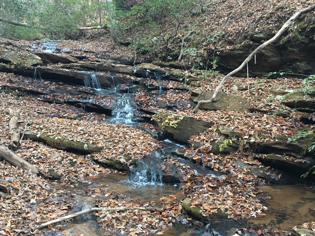
Upper Waldrop Stone Falls
- Height: 10 feet
- Type: Slanted stairstep
- Stream: Tributary of Twelvemile Creek
- River Basin: Savannah River
- Elevation: 756 feet
- Landowner: University of Clemson
- Recreational Area: Clemson Experimental Forest
- State: South Carolina
- County: Pickens
- USGS Map: Clemson
- Difficulty: Easy
- Accessibility: Logging road and trail
- Trail Blaze: None
- Admission Fee: None
- Hike Length: 0.8 miles
- Waterfall GPS: 34.73951 -82.82164
- Parking GPS: 34.73841 -82.82622
Overview
Waldrop Stone Falls was originally known as Clemson Falls.
Driving Directions
From Clemson, South Carolina. From the intersection of US-76, head north on College Avenue (SC-133) for 3.4 miles and turn right onto Madden Bridge Road. Drive 0.2 miles and turn left onto Waldrop Stone Road and park on the right-side of the road near the cabled off road. Do not block the road!
From Six Mile, South Carolina. From city center, head south on SC-133 for 5.2 miles to a intersection and continue straight onto Madden Bridge Road. Drive 0.2 miles and turn left onto Waldrop Stone Road and park on the right-side of the road near the cabled off road. Do not block the road!
From Six Mile, South Carolina. From city center, head south on SC-133 for 5.2 miles to a intersection and continue straight onto Madden Bridge Road. Drive 0.2 miles and turn left onto Waldrop Stone Road and park on the right-side of the road near the cabled off road. Do not block the road!
Hiking Directions
From the parking. Follow the cabled off forest road for 140+ feet and head left onto a trail and follow it for 0.17 miles to a bridge crossing a creek. Once across head right and follow the creek downstream for 0.2 miles to the waterfall on the right-side of the trail.
For the opposite side of the loop. Follow the cabled off forest road for 0.34 miles and head left onto a trail heading downhill. Follow the trail for 580+ feet to a junction in the trail and head left. Follow the trail to a creek crossing, cross over and continue following the trail upstream to the waterfall on the left-side of the trail.
My GPS track can be found below. Click on the track name to be taken to the Gaia GPS website where you can save the track to your phone or computer.
