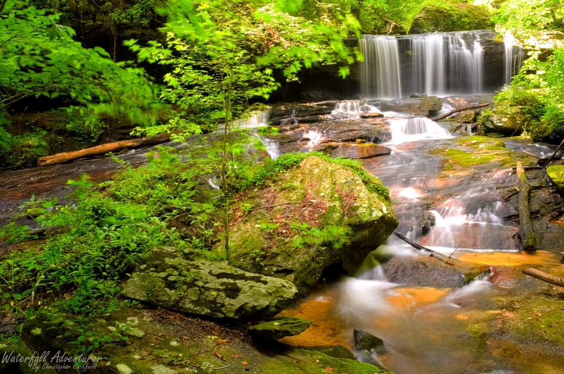
- Height: 28 feet
- Type: Free-fall into a long sliding cascade
- Stream: Cane Creek
- River Basin: Savannah River
- Elevation: 1,180 feet
- Landowner: City of Walhalla
- Recreational Area: Stumphouse Tunnel Park
- State: South Carolina
- County: Oconee
- USGS Map: Walhalla
- Difficulty: Strenuous
- Accessibility: Trail, bushwhack & creek walking
- Trail Blaze: None
- Admission Fee: $2 per vehicle
- Hike Length: 0.45 miles
- Waterfall GPS: 34.80576 -83.12076
- Parking GPS: 34.80760 -83.12157
Overview
Princess Veil Falls is surprisingly close to the well known Issaqueena Falls, but is unknown to almost everyone that visits there.
Driving Directions
From Walhalla, South Carolina. From the intersection of SC-183, head west on SC-28 for 5.5 miles and turn right onto Stumphouse Tunnel Road. Drive down the road to a pay box on the right. ($2 per vehicle, $5 for vehicles with trailers.) Once you've paid, continue down the road for 0.28 miles and turn right, then right again for the Issaqueena Falls parking.
From Cashiers, North Carolina. From the intersection of US-64, head south on NC-107 for 8.2 miles to the NC/SC border, where NC-107 turns into SC-107. Continue following SC-107 for 15 miles and turn left onto SC-28. Drive 2.7 miles and turn left onto Stumphouse Tunnel Road. Drive down the road to a pay box on the right. ($2 per vehicle, $5 for vehicles with trailers.) Once you've paid, continue down the road for 0.28 miles and turn right, then right again for the Issaqueena Falls parking.
From Cashiers, North Carolina. From the intersection of US-64, head south on NC-107 for 8.2 miles to the NC/SC border, where NC-107 turns into SC-107. Continue following SC-107 for 15 miles and turn left onto SC-28. Drive 2.7 miles and turn left onto Stumphouse Tunnel Road. Drive down the road to a pay box on the right. ($2 per vehicle, $5 for vehicles with trailers.) Once you've paid, continue down the road for 0.28 miles and turn right, then right again for the Issaqueena Falls parking.
Hiking Directions
From the parking. Head south towards the bridge and follow the trail for 360+ feet to a overlook of Issaqueena Falls. Follow any of the paths below the overlook deck down towards the creek. Once you're close to the creek you'll see a path that heads right, follow it to the base of the lowest drop of Issaqueena Falls. Cross over the creek to river left and follow a faint path downstream to the top of Big Boulder Falls. (Now the fun part. Be careful down here as there is a lot of slick rock!) To the far right of the falls (River right) there is a way down to the base, once at the base you'll need to cross the creek to river left and climb up the side of the hill to proceed to the base of Princess Veil Falls. If you can't figure out the path down river right of Big Boulder Falls, Don't proceed!
My GPS track can be found below. Click on the track name to be taken to the Gaia GPS website where you can save the track to your phone or computer.
My GPS track can be found below. Click on the track name to be taken to the Gaia GPS website where you can save the track to your phone or computer.

