Waterfall Adventurer
  • Home
  • Waterfalls
    • South Carolina
  • LiDAR
  • Tools
    • QGIS >
      • Download And How To Setup
      • Where To Download LiDAR Data
      • Processing LiDAR Point Cloud Data
      • Opening And Viewing Data
    • The National Map
  • Contact
  • Store
  • Disclaimer
  • More
    • QGIS Tips & Tricks
    • Resources
    • Understanding Waterfall Listings
    • Waterfall Adventurer Facebook Page
    • Waterfall Adventurer YouTube Page
Picture

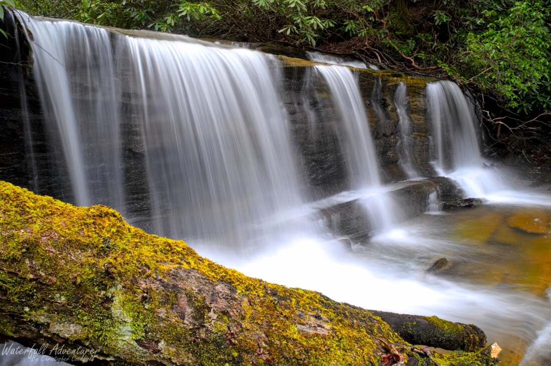
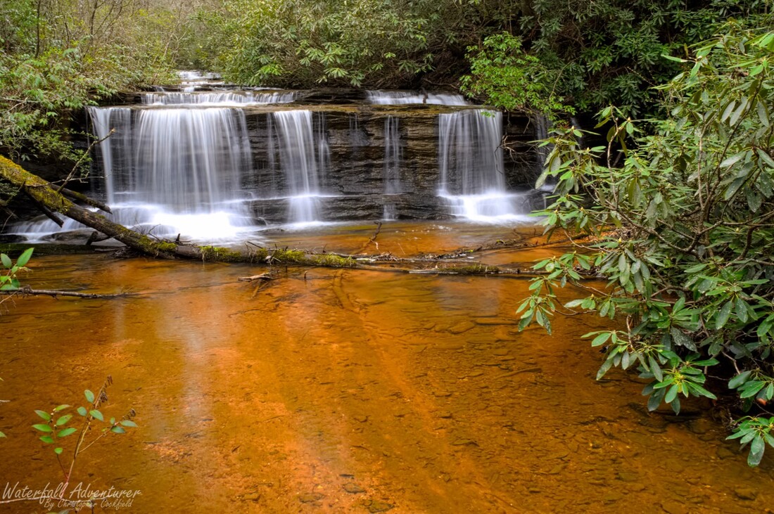
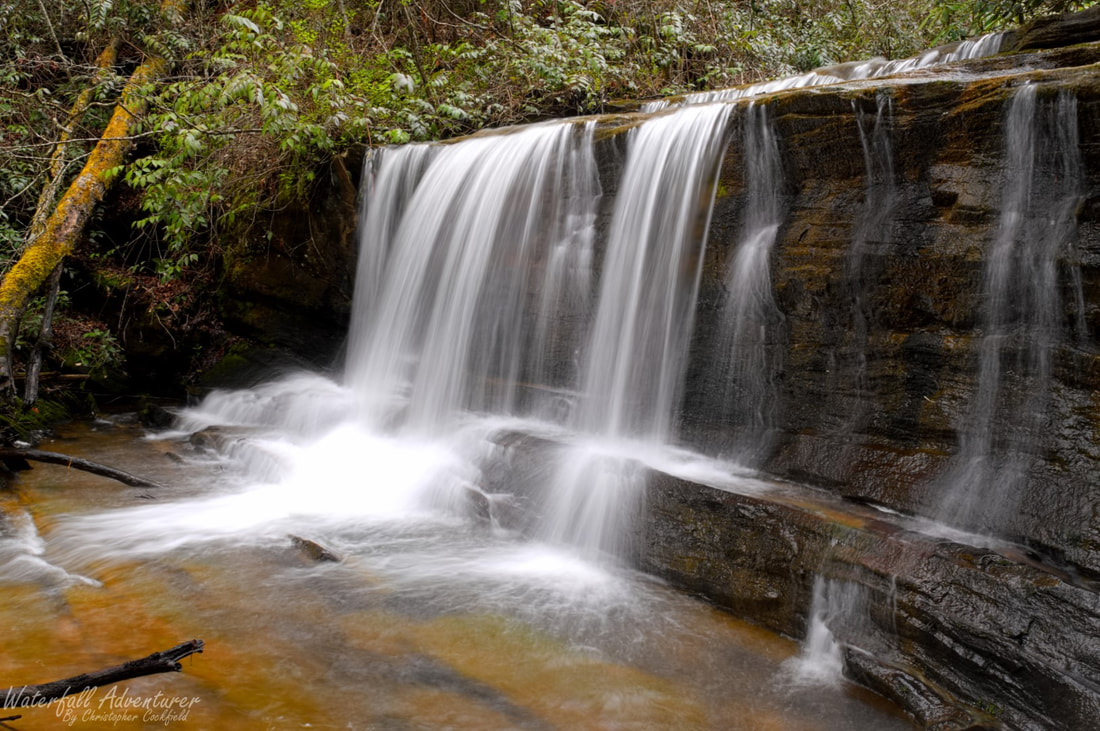
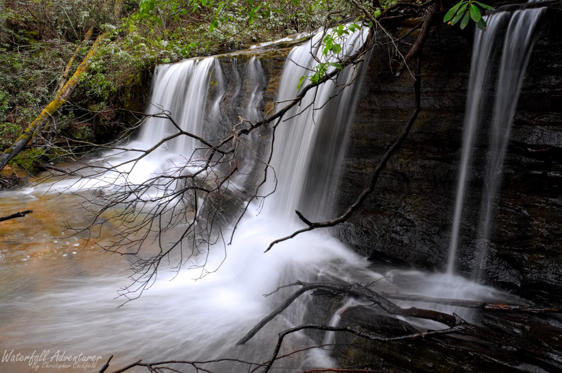
Middle Raines Mill Falls


  • Height: 8 feet
  • Type: Cascade into a free-fall
  • Stream: Fall Creek
  • River Basin: Savannah River
  • Elevation: 1,574 feet
  • Landowner: Raines Mill LLC
  • Recreational Area: N/A
  • State: South Carolina
  • County: Oconee
  • USGS Map: Whetstone
  • Difficulty: Easy
  • Accessibility: Forest road & trail
  • Trail Blaze: None
  • Admission Fee: None
  • Hike Length: 0.6 miles
  • Waterfall GPS: 34.81622 -83.24945
  • Parking GPS: 34.81752 -83.24569
Understanding Waterfall Listings

Overview

Raines Mill was built in 1914 and was owned by Reverend Luther Henry Raines. (April, 20, 1887 - April, 1, 1970.) The mill is a rustic 3-story structure with a 40-foot tall overshot water wheel, thought to be one of the largest overshot water wheels in the area. During the daytime the mill was used to ground corn and wheat and at night generated hydroelectric power for the nearby Long Creek Academy, which Luther Raines was principal and preacher of.

Due to the ongoing restoration of Raines Mill, please use caution when visiting.

Driving Directions

From Walhalla, South Carolina. From the intersection of SC-183, head west on SC-28 for 6.1 miles and turn left onto Whetstone Road. Drive 4.9 miles and turn left onto Chattooga Ridge Road. Drive 3.8 miles and turn right onto Fall Creek Road (FS-722). Drive 0.27 miles and park on the left side of the road near a gated road.

From Westminster, South Carolina. From the intersection of US-123, head north on US-76 for 15.4 miles and turn right onto Chattooga Ridge Road. Drive 2.1 miles and turn left onto Fall Creek Road (FS-722). Drive 0.27 miles and park on the left side of the road near a gated road.

From Clayton, Georgia. From the intersection of US-441, head east on US-76 for 10.3 miles and turn left onto Chattooga Ridge Road. Drive 2.1 miles and turn left onto Fall Creek Road (FS-722). Drive 0.27 miles and park on the left side of the road near a gated road.

Do not block the gated road!

Hiking Directions

From the parking. Head around the gate and follow the old road for 780+ feet to a fork in the road. Keep right and continue for 560+ feet to a picnic area and an historic mill on the left near the stream. Head towards the mill and go left around the mill and follow the path for 30+ feet to a faint path that heads right and down towards the stream and waterfall.

GPS Tracks


Photo Gallery

Picture
Picture
Picture

Waterfalls Nearby

  • Andrew Ramey Falls
  • Fall Creek Falls
  • Final Falls
  • Little Fall Creek Falls
  • Midway Falls
  • Pristine Falls
  • Raines Mill Falls (Lower)
  • Raines Mill Falls (Upper)
  • Rhodo Falls
  • Side Pocket Falls
Powered by Create your own unique website with customizable templates.
  • Home
  • Waterfalls
    • South Carolina
  • LiDAR
  • Tools
    • QGIS >
      • Download And How To Setup
      • Where To Download LiDAR Data
      • Processing LiDAR Point Cloud Data
      • Opening And Viewing Data
    • The National Map
  • Contact
  • Store
  • Disclaimer
  • More
    • QGIS Tips & Tricks
    • Resources
    • Understanding Waterfall Listings
    • Waterfall Adventurer Facebook Page
    • Waterfall Adventurer YouTube Page