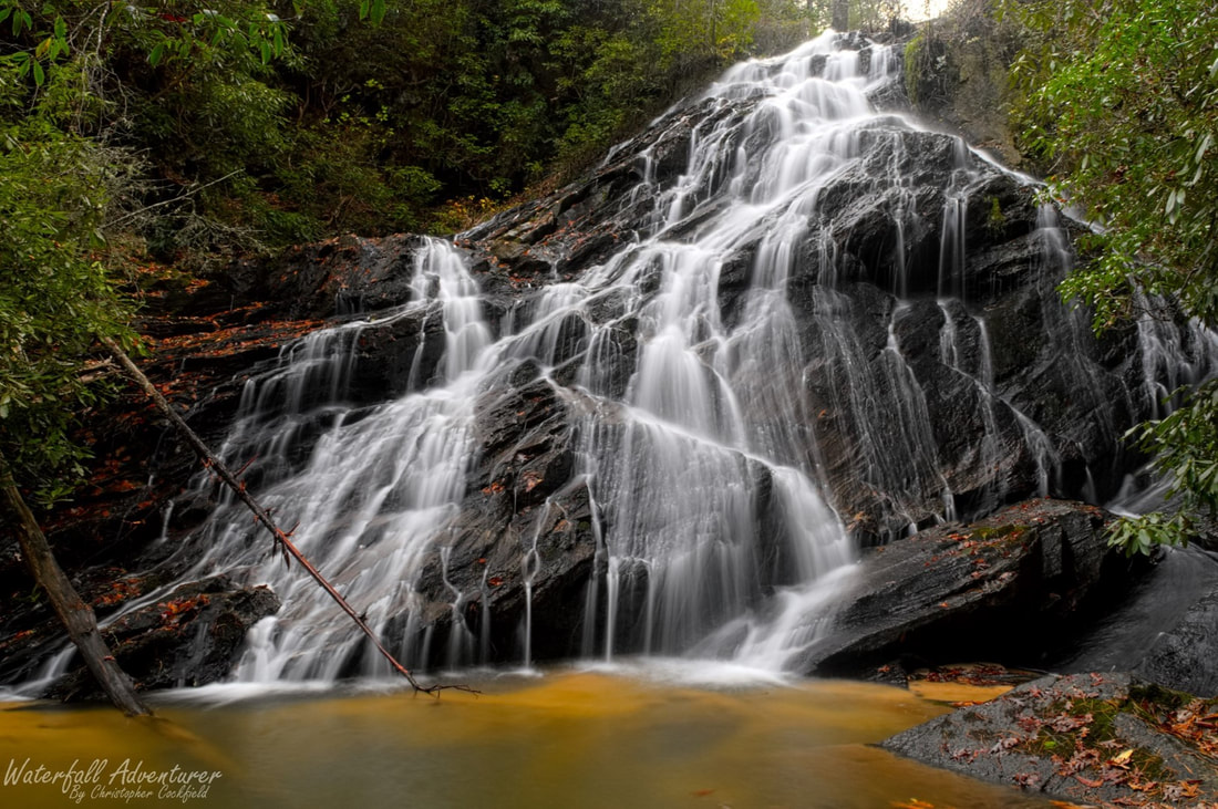
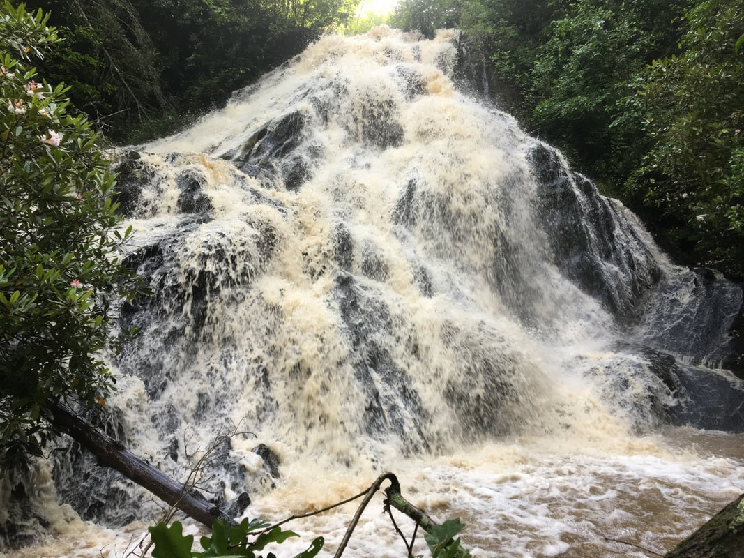
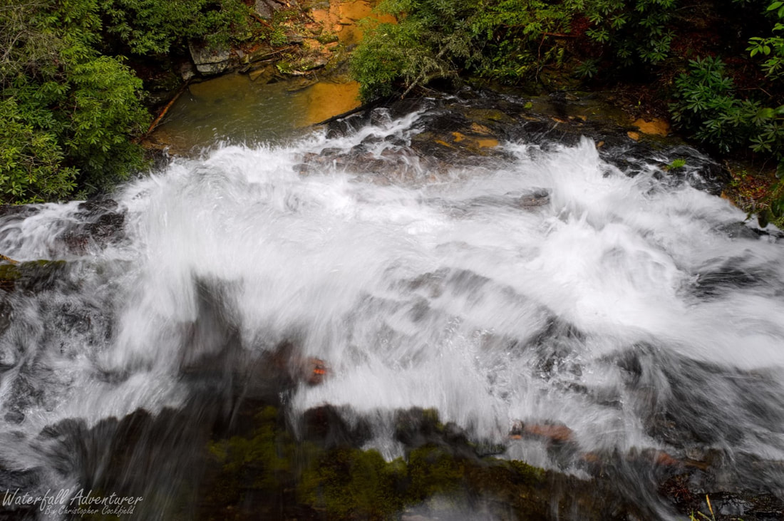
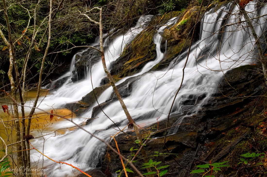
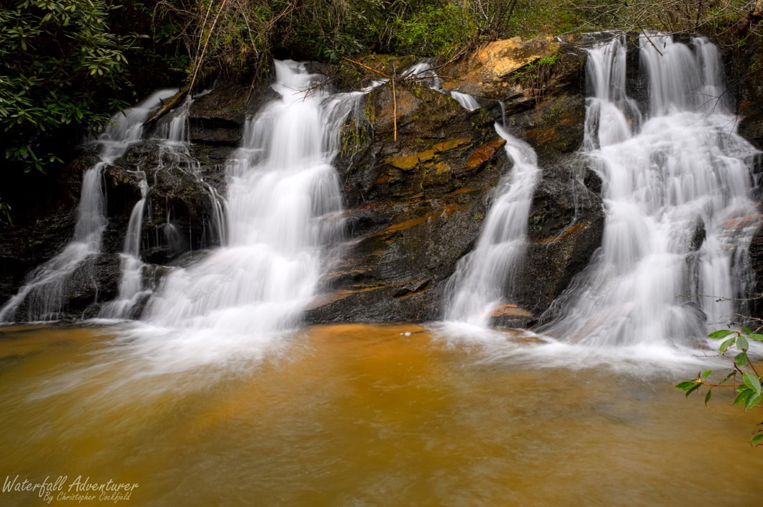
Limestone Falls
- Height: 56 feet
- Type: Cascade into a weaving spider web of drops
- Stream: Limestone Creek
- River Basin: Savannah River
- Elevation: 1,526 feet
- Landowner: Private
- Recreational Area:
- State: South Carolina
- County: Oconee
- USGS Map: Whetstone
- Difficulty: Easy to moderate
- Accessibility: Old road, path & scramble
- Trail Blaze: None
- Admission Fee: None
- Hike Length: 0.4 mile
- Waterfall GPS: 34.82975 -83.18753
- Parking GPS: 34.82783 -83.18840
Overview
|
Limestone Falls and part of the path near the top of the waterfall is on Private Property, but isn't currently posted, so be on your best behavior when visiting.
|
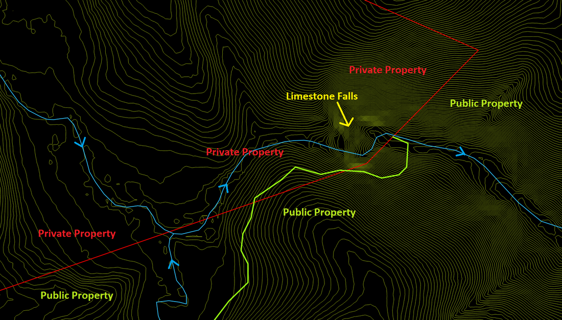
Parcel data overlaid on 2-foot contour data to show where the boundary line is and where the path intersects the boundary line, plus showing how much of the waterfall is on private property.
|
Driving Directions
From Walhalla, South Carolina. From the intersection of SC-183, head west on SC-28 for 6.1 miles and turn left onto Whetstone Road. Drive 4.9 miles and turn left onto Chattooga Ridge Road. Drive 1.6 miles and turn left onto Grapevine Branch Road (FS-764). Drive 1.88 miles to where the road does an almost hairpin curve to the right and a old road enters from the left. Park near the old road.
From Westminster, South Carolina. From the intersection of US-123, head north on US-76 for 13 miles and turn right onto Academy Road. Drive 3.2 miles and turn right onto Chattooga Ridge Road. Drive 2.3 miles and turn right onto Grapevine Branch Road (FS-764). Drive 1.88 miles to where the road does an almost hairpin curve to the right and a old road enters from the left. Park near the old road.
From Clayton, Georgia. From US-441, head east on US-76 for 10.3 miles and turn left onto Chattooga Ridge Road. Drive 4.3 miles and turn right onto Grapevine Branch Road (FS-764). Drive 1.88 miles to where the road does an almost hairpin curve to the right and a old road enters from the left. Park near the old road.
Hiking Directions
From the parking. Follow the old road down for 300+ feet to a small stream. Head right and follow the path for 600+ feet to where the path curves right and the land starts dropping off to your left. Continue following the path to a tree with a white rope tied to it and a steep path heading down to the stream. Carefully scramble down the hillside to the stream and head upstream to the waterfall.
My GPS track can be found below. Click on the track name to be taken to the Gaia GPS website where you can save the track to your phone or computer.
My GPS track can be found below. Click on the track name to be taken to the Gaia GPS website where you can save the track to your phone or computer.
|
|
|
|
Waterfalls Nearby
- Moonshine Falls
