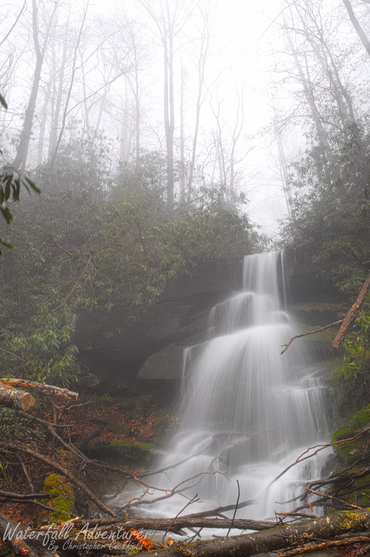
- Height: 30 feet
- Type: Cascading free-fall
- Stream: Laurel Fork Creek
- River Basin: Savannah River
- Elevation: 2,104 feet
- Landowner: South Carolina Department of Natural Resources
- Recreational Area: Laurel Fork Heritage Preserve
- State: South Carolina
- County: Pickens
- USGS Map: Eastatoe Gap
- Difficulty: Strenuous to very strenuous
- Accessibility: Road, bushwhack & creek walking
- Trail Blaze: None
- Admission Fee: None
- Hike Length: 2.3 miles
- Waterfall GPS: 35.05376 -82.84577
- Parking GPS: 35.04400 -82.83817
Overview
Christopher Falls is an amazing discovery of mine using LiDAR.
Driving Directions
From Pickens, South Carolina. From the intersection of SC-183, head northwest on US-178 for 16.7 miles and turn left onto Laurel Valley Road, just after the bridge. Keeping right at the fork, drive 3.6 miles on Horse Pasture Road to Laurel Fork Gap and park on the left-side of the road in a small parking space near the intersection of Horse Pasture Road and Canebrake Road.
From Rosman, North Carolina. From city center, head southwest on US-178 for 8.4 miles and turn right onto Laurel Valley Road, just before the bridge. Keeping right at the fork, drive 3.6 miles on Horse Pasture Road to Laurel Fork Gap and park on the left-side of the road in a small parking space near the intersection of Horse Pasture Road and Canebrake Road.
Low clearance vehicles will have a hard time on the Horse Pasture Road!
Hiking Directions
From the parking. Head up Canebrake Road for 0.37 miles to the junction of Foothills Trail and continue following Canebrake Road for another 0.34 miles to a split in the road and keep left. Follow the road for 0.25 miles to where the road straightens out a bit after a S curve and head west. (If the gate is open and you have a 4x4, you can drive to this point and park on the side of the road 35.05407 -82.84382.) Bushwhack down a steep ridge for 860+ feet to a creek. (You should come out near a confluence of two creeks 35.05327 -82.84613.) Cross the creek and head upstream on the creek you crossed a short ways to the waterfall.
My GPS track can be found below. Click on the track name to be taken to the Gaia GPS website where you can save the track to your phone or computer.
My GPS track can be found below. Click on the track name to be taken to the Gaia GPS website where you can save the track to your phone or computer.
Waterfalls Nearby
- Abbey Falls
- Bella Falls
- Big Cliff Falls
- Bonita Falls
- Bushwhack Falls
- Creekside Falls
- Evil Ducky Falls
- Hidden Veil Falls
- Laurel Fork Falls
- Louie Falls
- Lower Doghobble Hell Falls
- Middle Doghobble Hell Falls
- Upper Laurel Fork Falls
- Virginia Hawkins Falls
