Long Shoals
- Height: 26 feet
- Type: Long cascading slide
- Stream: Little Eastatoe Creek
- River Basin: Savannah River
- Elevation: 872 feet
- Landowner: South Carolina Forestry Commission
- Recreational Area: Long Shoals Wayside Park
- State: South Carolina
- County: Pickens
- USGS Map: Sunset
- Difficulty: Easy
- Accessibility: Trail
- Trail Blaze: None
- Admission Fee: None
- Hike Length: 350+ feet
- Waterfall GPS: 34.94865 -82.85069
- Parking GPS: 34.94857 -82.85136
Overview
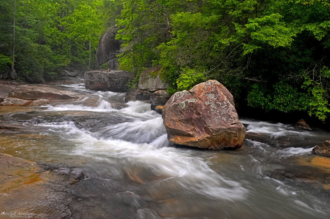
Long Shoals isn't really nice by itself, but with the house sized boulders that sit on the stream left-side of the creek, it's quite picturesque. In the warmer months, expect to see a lot of people swimming and sliding down the shoal, especially on weekends.
Long Shoals is also a popular fishing spot as the South Carolina Department of Natural Resources stocks this portion of the Little Eastatoe Creek with Brook, Brown and Rainbow Trout.
Long Shoals is also a popular fishing spot as the South Carolina Department of Natural Resources stocks this portion of the Little Eastatoe Creek with Brook, Brown and Rainbow Trout.
Driving Directions
From Pickens, South Carolina. From the intersection of US-178, head west on SC-183 for 1.1 miles and turn right onto Shady Grove Road. Drive 7 miles and turn right onto Little Eastatoee Road. Drive 3 miles and turn left onto Cherokee Foothills Scenic Highway (SC-11). Drive 1.4 miles and turn left into Long Shoals Wayside Park.
From Salem, South Carolina. From city center, head northwest on SC-130 for 1.3 miles and turn right onto Cherokee Foothills Scenic Highway (SC-11). Drive 8.5 miles and turn right into Long Shoals Wayside Park.
From Rosman, North Carolina. From city center, head southwest on US-178 for 16.5 miles and turn right onto Cherokee Foot-hills Scenic Highway (SC-11). Drive 6.3 miles and turn left into Long Shoals Wayside Park.
Hiking Directions
From the parking. In the northeast corner of the parking is a dilapidated staircase that heads down a short distance to the creek and shoal.
My GPS track can be found below. Click on the track name to be taken to the Gaia GPS website where you can save the track to your phone or computer.
My GPS track can be found below. Click on the track name to be taken to the Gaia GPS website where you can save the track to your phone or computer.
Waterfalls Nearby
- Crosscut Falls
- Poe Creek Falls (Lower)
- Poe Creek Falls (Middle)
- Poe Creek Falls (Upper)
- Sandy Beach Cascades
- Spelunker Falls
- Triple Falls
