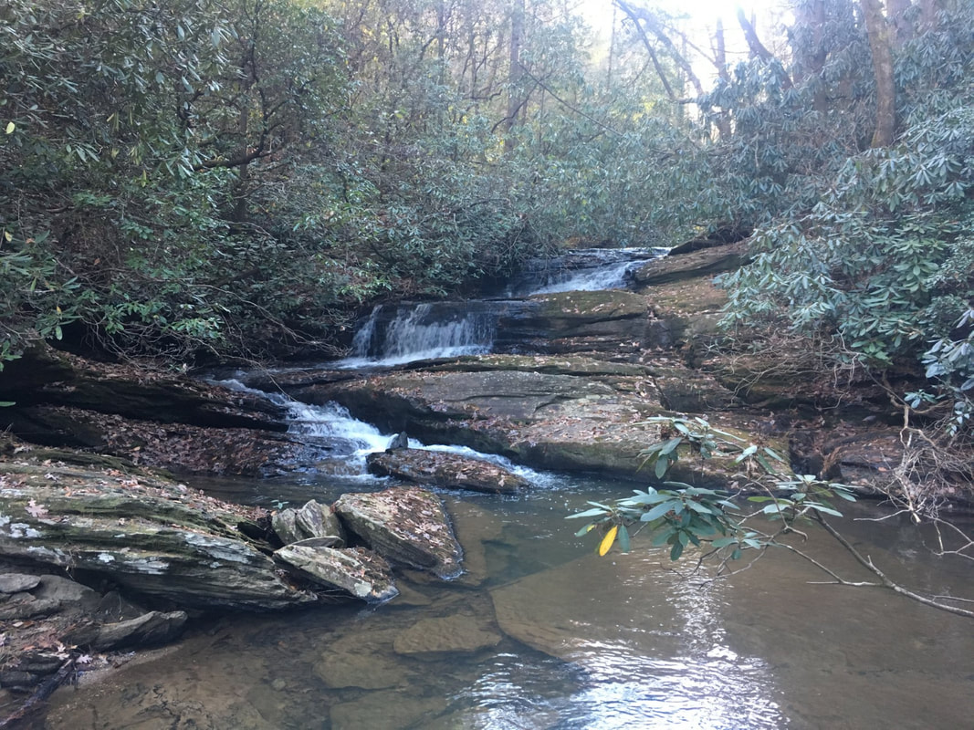
Bone Camp Creek Falls
- Height: 12 feet
- Type: Cascading slide
- Stream: Bone Camp Creek
- River Basin: Savannah River
- Elevation: 1,500 feet
- Landowner: U.S. Department of Agriculture
- Recreational Area: Sumter National Forest, Andrew Pickens Ranger District
- State: South Carolina
- County: Oconee
- USGS Map: Whetstone
- Difficulty: Moderate to strenuous
- Accessibility: Bushwhack
- Trail Blaze: None
- Admission Fee: None
- Hike Length: 0.6 miles
- Waterfall GPS: 34.80477 -83.17780
- Parking GPS: 34.80546 -83.18283
Overview
Driving Directions
From Walhalla, South Carolina. From the intersection of SC-183, head west on SC-28 for 6.1 miles and turn left onto Whetstone Road. Drive 0.7 miles and turn left onto Cassidy Bridge Road. Drive 2.9 miles and turn right onto Bone Camp Road. Drive 0.6 miles and turn right at the fork. Drive 0.25 miles and park on the right side of the road.
From Cashiers, North Carolina. From the intersection of US-64, head south on NC-107 for 8.2 miles to the NC/SC border, where NC-107 turns into SC-107. Continue following SC-107 for 15 miles and turn left onto SC-28. Drive 2 miles and turn right onto Whetstone Road. Drive 0.7 miles and turn left onto Cassidy Bridge Road. Drive 2.9 miles and turn right onto Bone Camp Road. Drive 0.6 miles and turn right at the fork. Drive 0.25 miles and park on the right side of the road.
From Cashiers, North Carolina. From the intersection of US-64, head south on NC-107 for 8.2 miles to the NC/SC border, where NC-107 turns into SC-107. Continue following SC-107 for 15 miles and turn left onto SC-28. Drive 2 miles and turn right onto Whetstone Road. Drive 0.7 miles and turn left onto Cassidy Bridge Road. Drive 2.9 miles and turn right onto Bone Camp Road. Drive 0.6 miles and turn right at the fork. Drive 0.25 miles and park on the right side of the road.
Hiking Directions
From the parking. head east down the ridgeline into the valley and make your way to the creek (close to 700 feet.) From there bushwhack 880+ feet upstream to the falls.
My GPS track can be found below. Click on the track name to be taken to the Gaia GPS website where you can save the track to your phone or computer.
My GPS track can be found below. Click on the track name to be taken to the Gaia GPS website where you can save the track to your phone or computer.
