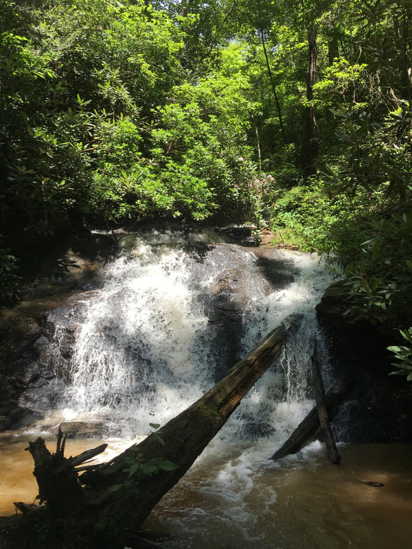
Middle Spider Valley Falls
- Height: 18 feet
- Type: Steep cascade
- Stream: Spider Valley Creek
- River Basin: Savannah River
- Elevation: 1,334 feet
- Landowner: U.S. Department of Agriculture
- Recreational Area: Sumter National Forest, Andrew Pickens Ranger District
- State: South Carolina
- County: Oconee
- USGS Map: Whetstone
- Difficulty: Strenuous to very strenuous
- Accessibility: Bushwhack
- Trail Blaze: None
- Admission Fee: None
- Hike Length: 0.33 miles
- Waterfall GPS: 34.76679 -83.24237
- Parking GPS: 34.76874 -83.24142
Overview
Driving Directions
From Walhalla, South Carolina. From the intersection of SC-183, head west on SC-28 for 6.1 miles and turn left onto Whetstone Road. Drive 0.7 miles and turn left onto Cassidy Bridge Road. Drive 7.4 miles and turn left onto Academy Road. Drive 0.3 miles and turn left onto Spider Valley Road. Drive 1 mile and turn right onto Persimmon Road. Drive 1.08 miles and park on the right side of the road in the tall grassy area.
From Westminster, South Carolina. From the intersection of US-123, head north on US-76 for 13 miles and turn right onto Academy Road. Drive 1.2 miles and turn right onto Spider Valley Road. Drive 1 mile and turn right onto Persimmon Road. Drive 1.08 miles and park on the right side of the road in the tall grassy area.
From Clayton, Georgia. From the intersection of US-441, head east on US-76 for 10.9 miles and turn left onto Raines Road. Drive 1.6 miles and go straight onto Spider Valley Road. Drive 1 mile and turn right onto Persimmon Road. Drive 1.08 miles and park on the right side of the road in the tall grassy area.
Hiking Directions
Without a GPS or being good at map reading you'll most definitely get lost out here. If you do decide to go, you'll be fighting your way through a thick forest and steep terrain.
My GPS track can be found below. Click on the track name to be taken to the Gaia GPS website where you can save the track to your phone or computer.
My GPS track can be found below. Click on the track name to be taken to the Gaia GPS website where you can save the track to your phone or computer.
