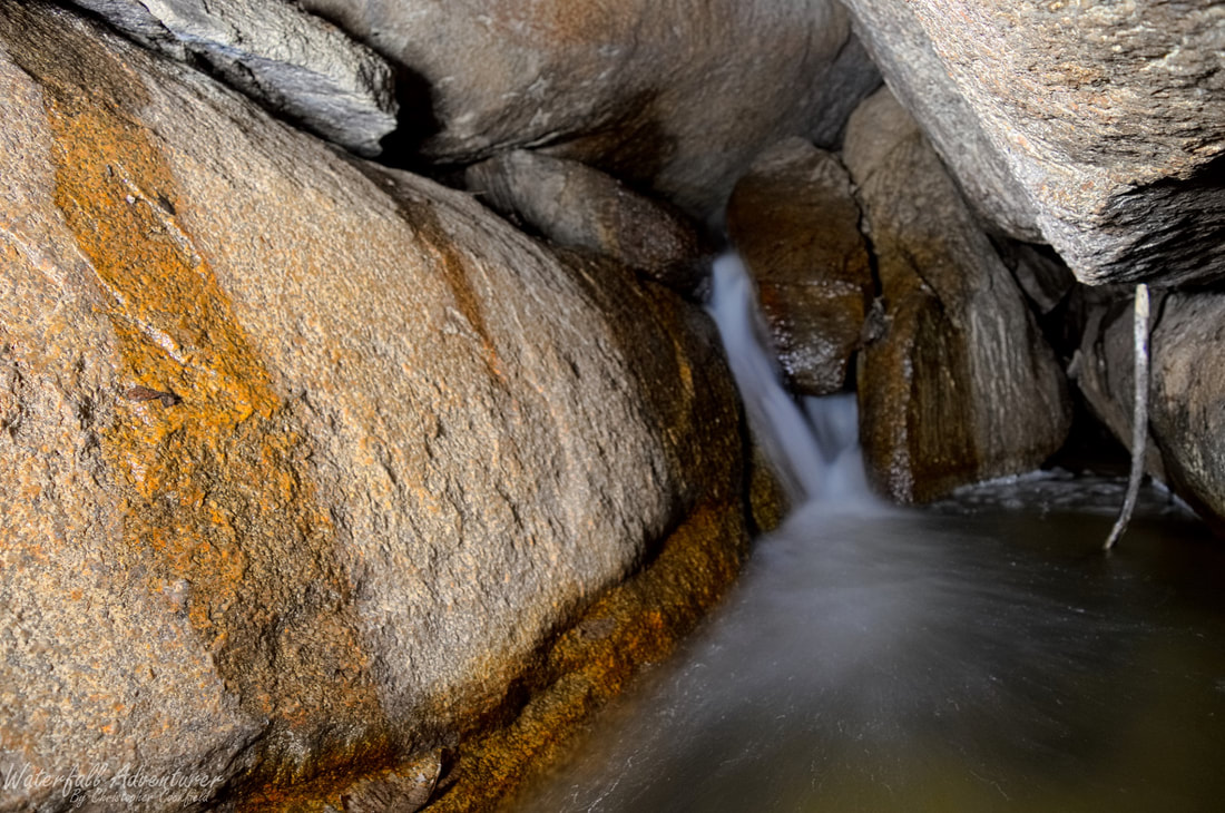
Subterranean Falls
- Height: 4 feet
- Type: Cascade
- Stream: Tributary of Flat Creek
- River Basin: Great Pee Dee River
- Elevation: 440 feet?
- Landowner: South Carolina Wildlife & Marine Resources Department
- Recreational Area: 40 Acre Rock Heritage Preserve
- State: South Carolina
- County: Lancaster
- USGS Map: Taxahaw
- Difficulty: Moderate to strenuous
- Accessibility: Trail, bouldering & creek-walking
- Trail Blaze: None
- Admission Fee: None
- Hike Length: 0.56 miles
- Waterfall GPS: 34.665783 -80.513320
- Parking GPS: 34.665341 -80.516971
Overview
I can't find a name for this waterfall, so I'm calling it Subterranean Falls as it's underground. As of 1/25/2020, there's no longer water going over the top of the rocks, its now going under.
Driving Directions
From Kershaw, South Carolina. From the intersection of US-521 BUS, head east on US-601 for 8.5 miles and turn left onto Nature Reserve Road. Drive 0.8 miles and park on the right-side of the road in a small dirt area.
From Lancaster, South Carolina. From the intersection of US-521 BUS, head north on US-521 for 1.4 miles and take the SC-903 exit toward Lancaster/Hartsville and turn right onto SC-903 (Flat Creek Road). Drive 14.9 miles and merge onto US-601. Drive 1.5 miles and turn left onto Nature Reserve Road. Drive 0.8 miles and park on the right-side of the road in a small dirt area.
From Pageland, South Carolina. From the intersection of SC-9, head south on US-601 for 8.2 miles and turn right onto Nature Reserve Road. Drive 0.8 miles and park on the right-side of the road in a small dirt area.
Hiking Directions
From the parking. Head east and follow a unmarked trail for 0.22 miles to a large bare rock. Head northeast across the rock and pick the trail back up and follow it to the creek. (You'll pop out at a unnamed waterfall, that I'm calling Little Cedar Falls.) Head downstream and carefully rock hop and boulder your way on the left-side of the creek to a house size cave made by huge boulders. Once inside of the cave turn left to a dark narrow passage with water flowing out of it and head upstream through the passage to the waterfall. You'll need a flashlight to see as it's very dark inside the passage!
