Clipping
Clipping is a very useful feature that allows you to cut a smaller section out of a larger map, so for instance most of the LiDAR maps I deal with are county sized, so if I wanted a smaller section cut out of the map, I would need to use clipping.
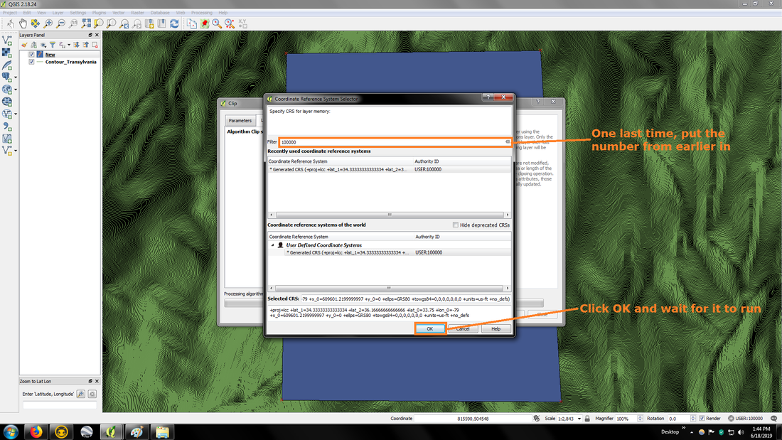
Now it's not exactly that easy, as you do have to make sure the CRS (coordinate reference system) of the layers match or you'll end up with an empty map. I'll show you 2 different ways of clipping a section out of a map that I know of. I used QGIS 2.18.24 for the instructions below, newer versions may differ.
Now it's not exactly that easy, as you do have to make sure the CRS (coordinate reference system) of the layers match or you'll end up with an empty map. I'll show you 2 different ways of clipping a section out of a map that I know of. I used QGIS 2.18.24 for the instructions below, newer versions may differ.
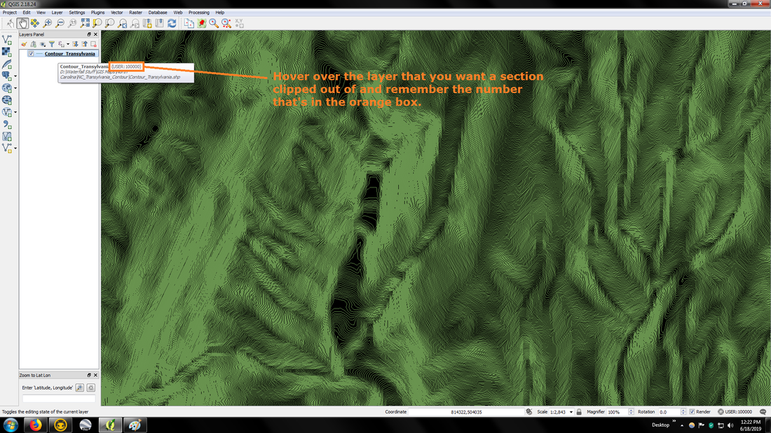
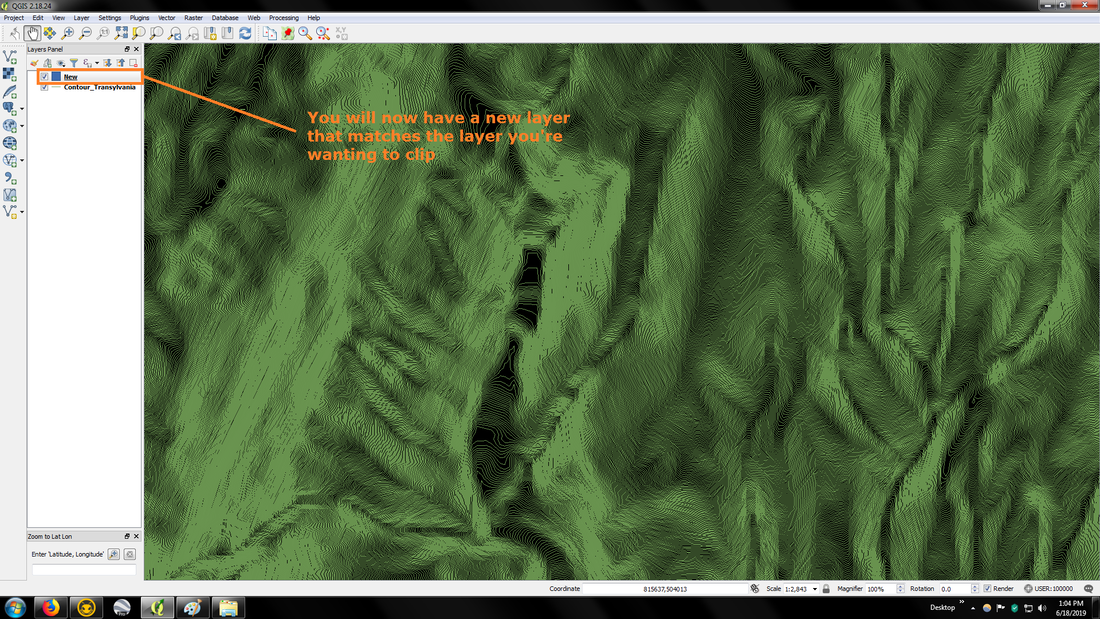
Step #1
|
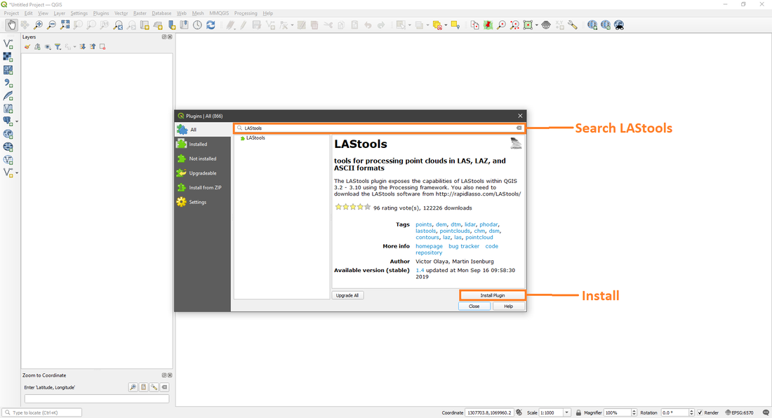
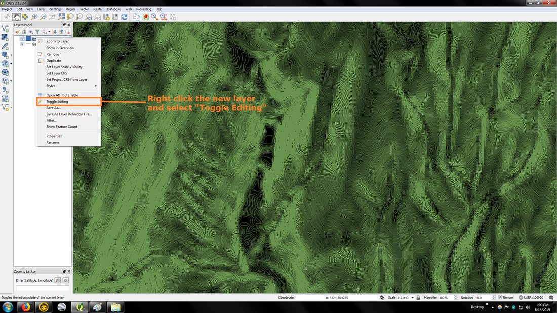
Step #2
|
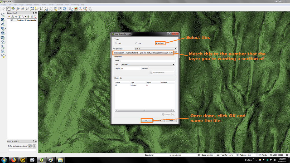
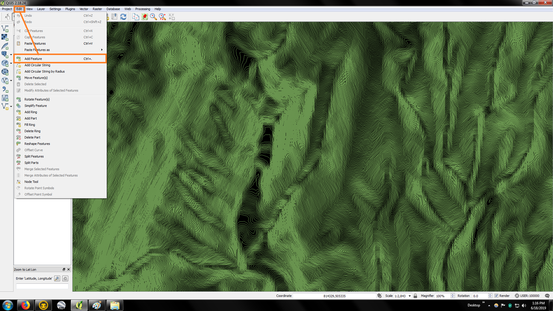
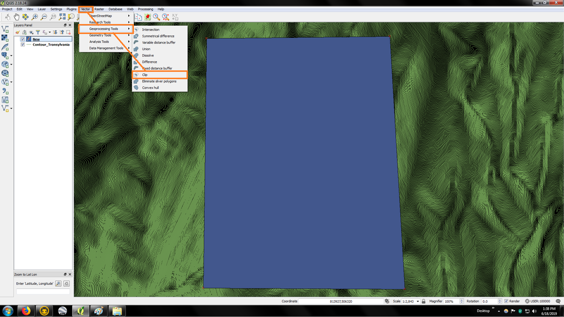
Step #3
|
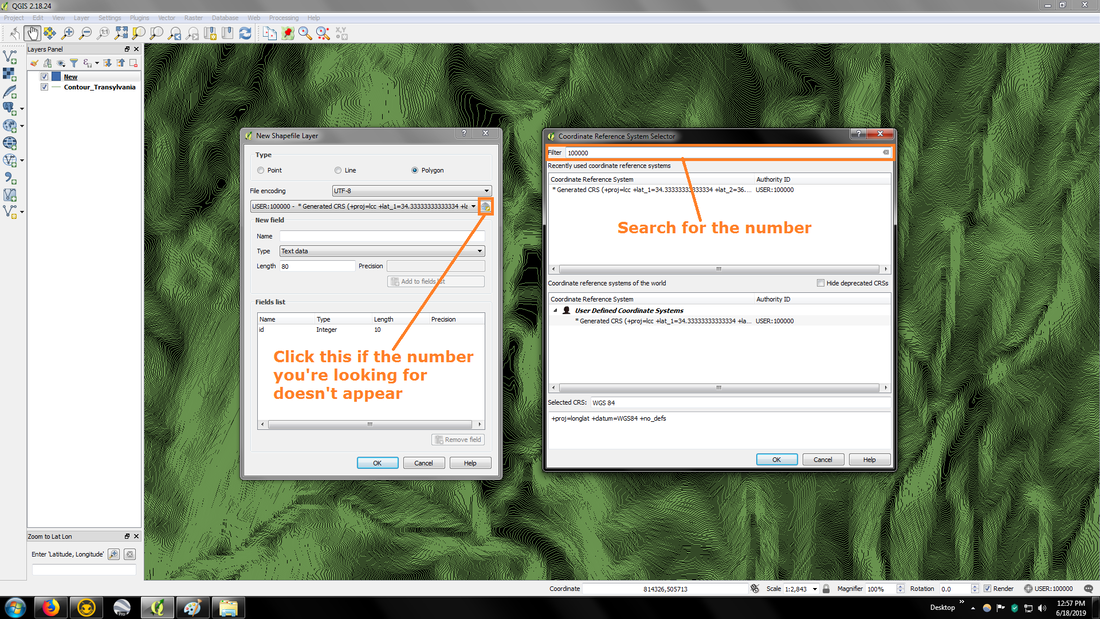
Step #3 if number doesn't appear
|
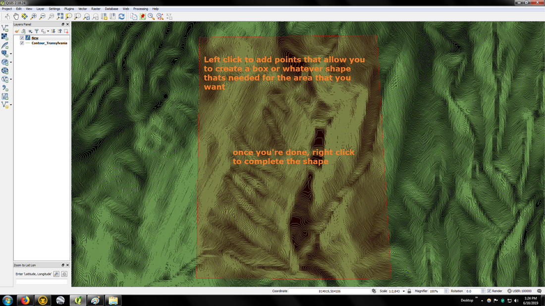
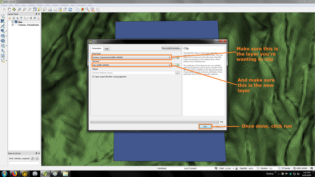
Step #4
|
Step #5
|
Make sure to left click the new layer to have it selected, otherwise the next part wont work.
Step #6
|
Step #7
|
Step #8
|
Step #9
|
Step #10
|
Step #11
|
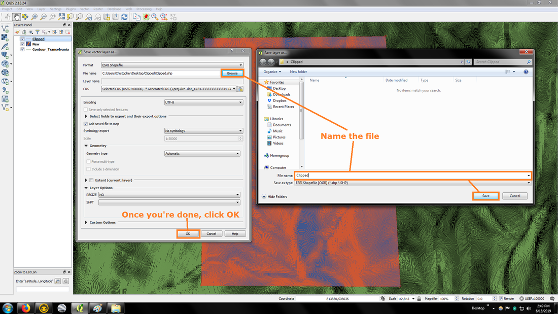
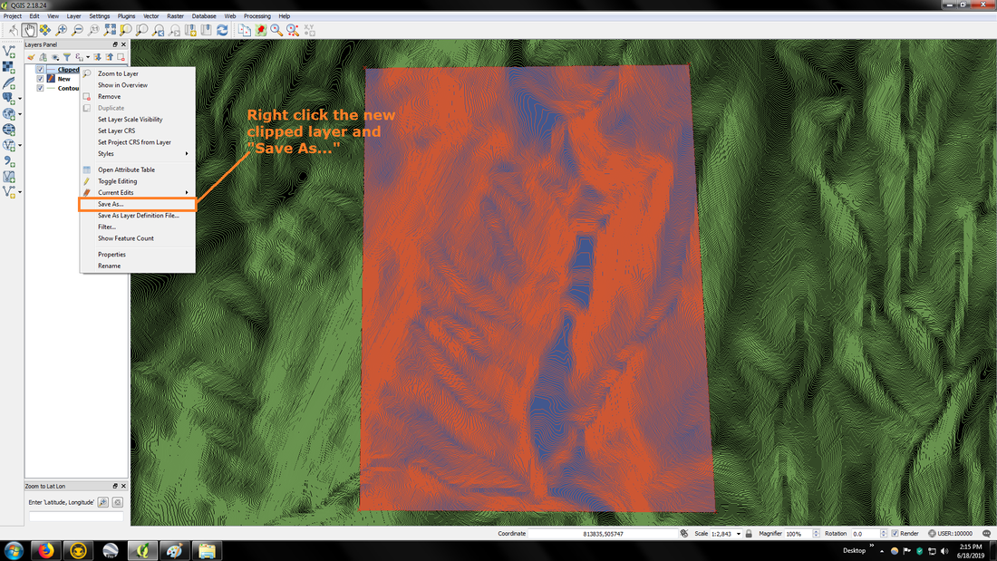
Step #12
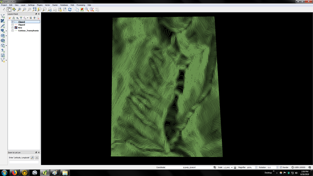
Finished product.
Now to use a map that's already created, that doesn't have the same CRS as the map you want to clip, you'll need to save it as the same CRS, which is pretty straightforward.
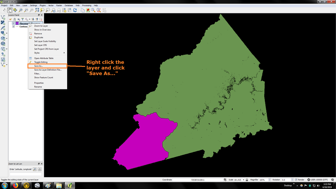
|
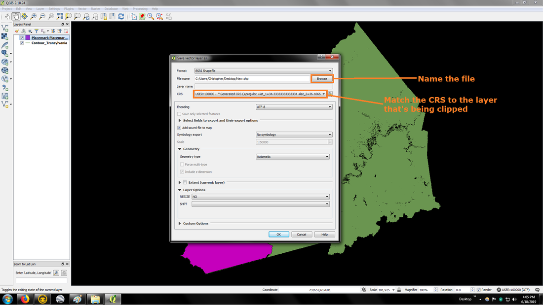
|
You'll now do everything you did at step #8 through step #12 on the the new layer.
You've now learned the 2 different ways of clipping a smaller section out of a bigger map and can now experiment with the possibilities.
