Waterfall Adventurer
  • Home
  • Waterfalls
    • South Carolina
  • LiDAR
  • Tools
    • QGIS >
      • Download And How To Setup
      • Where To Download LiDAR Data
      • Processing LiDAR Point Cloud Data
      • Opening And Viewing Data
    • The National Map
  • Contact
  • Store
  • Disclaimer
  • More
    • QGIS Tips & Tricks
    • Resources
    • Understanding Waterfall Listings
    • Waterfall Adventurer Facebook Page
    • Waterfall Adventurer YouTube Page

Changing the Colors


One of the first things I changed on QGIS was the background color, as the bright white color takes a toll on my eyes, so I messed around with the colors until I found one that didn't bother me when working with maps for long hours. The color that I found to be best for long hours is black, but you can use any color that suits your eyes.

Picture
Picture
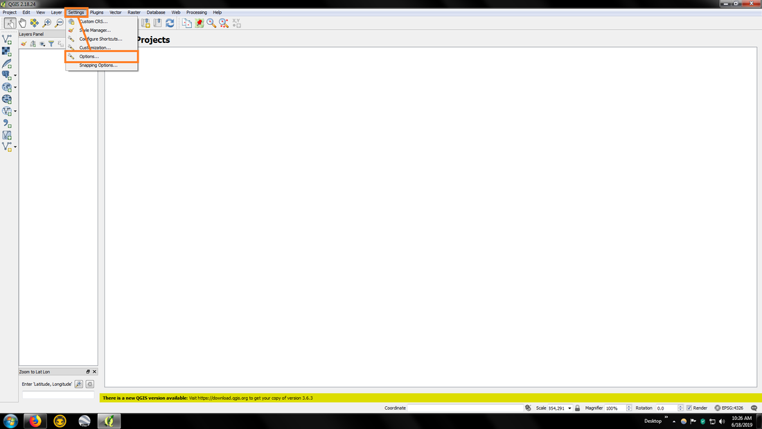
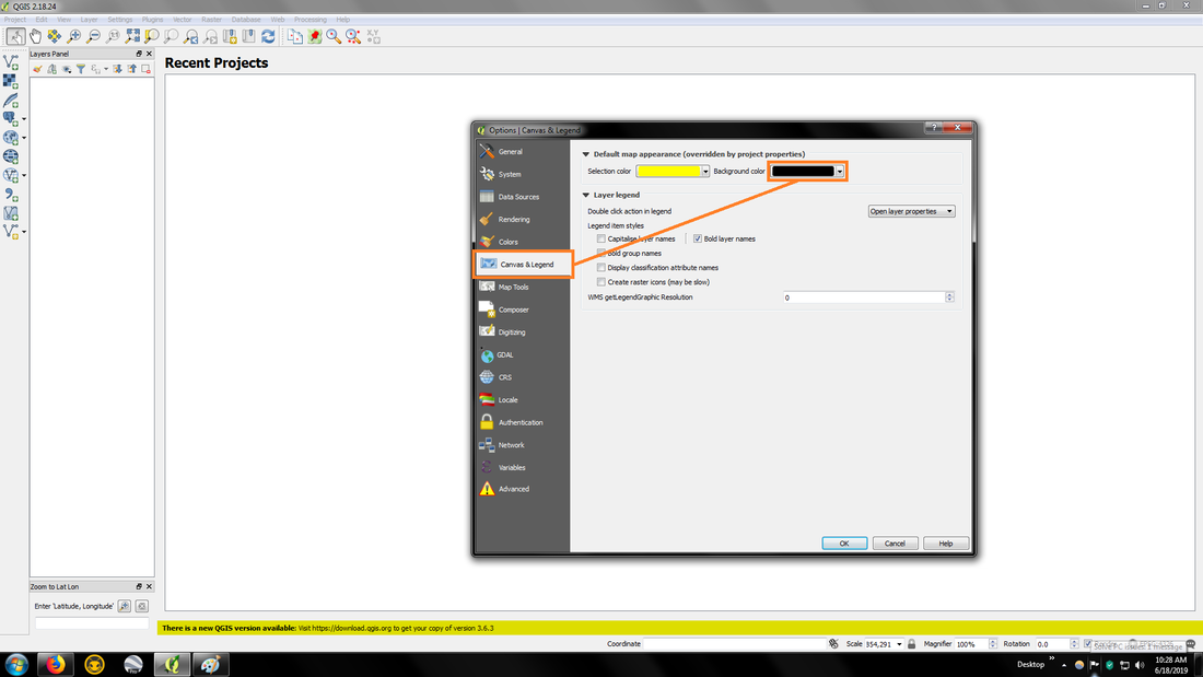
Once you've changed the color and clicked OK, close QGIS and open it back to apply the change.

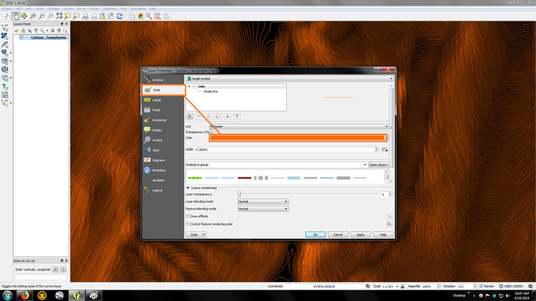
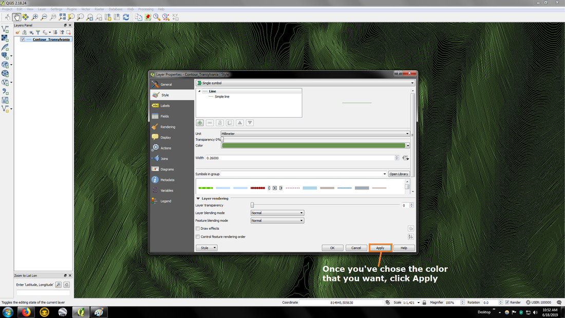
You can also change the color of the data that you input into QGIS, so for instance I change the color of contours to a green color, but again it's what is best for your eyes.
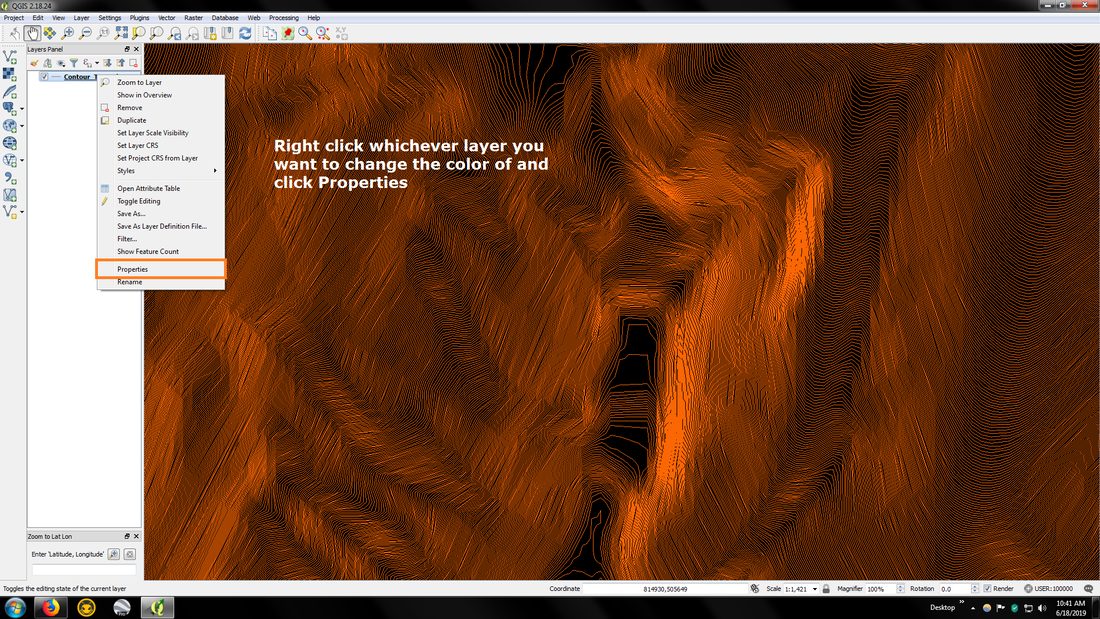
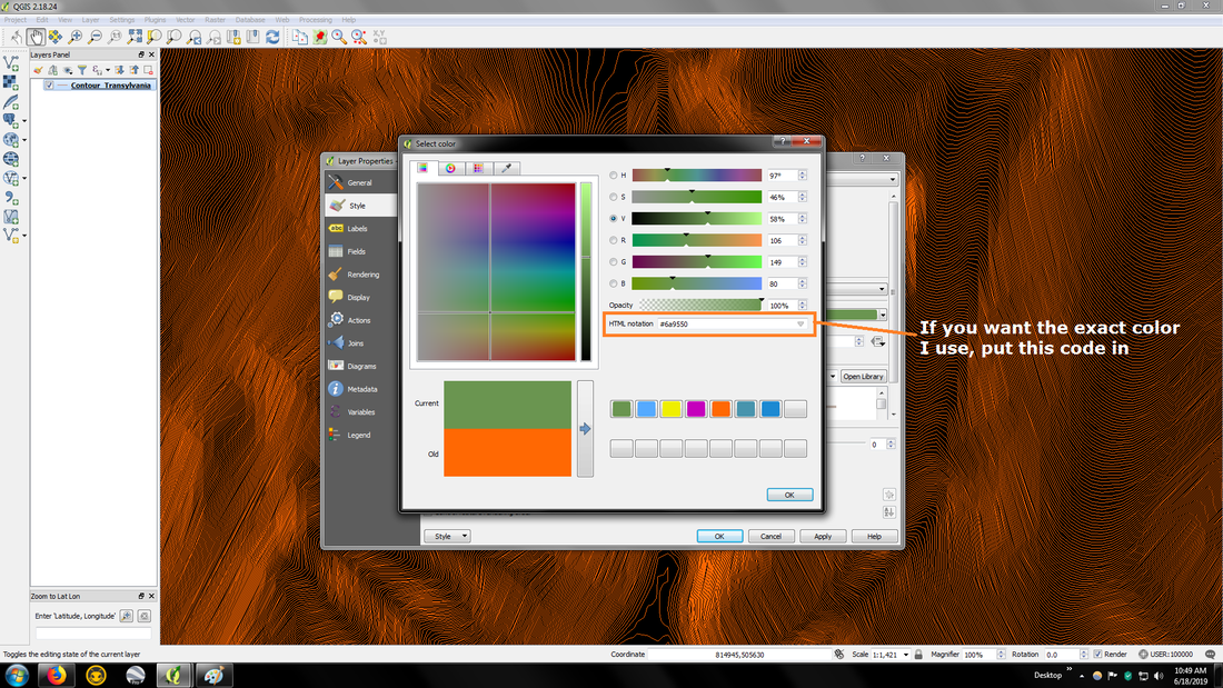
Picture
Picture
Picture
Picture
Powered by Create your own unique website with customizable templates.
  • Home
  • Waterfalls
    • South Carolina
  • LiDAR
  • Tools
    • QGIS >
      • Download And How To Setup
      • Where To Download LiDAR Data
      • Processing LiDAR Point Cloud Data
      • Opening And Viewing Data
    • The National Map
  • Contact
  • Store
  • Disclaimer
  • More
    • QGIS Tips & Tricks
    • Resources
    • Understanding Waterfall Listings
    • Waterfall Adventurer Facebook Page
    • Waterfall Adventurer YouTube Page