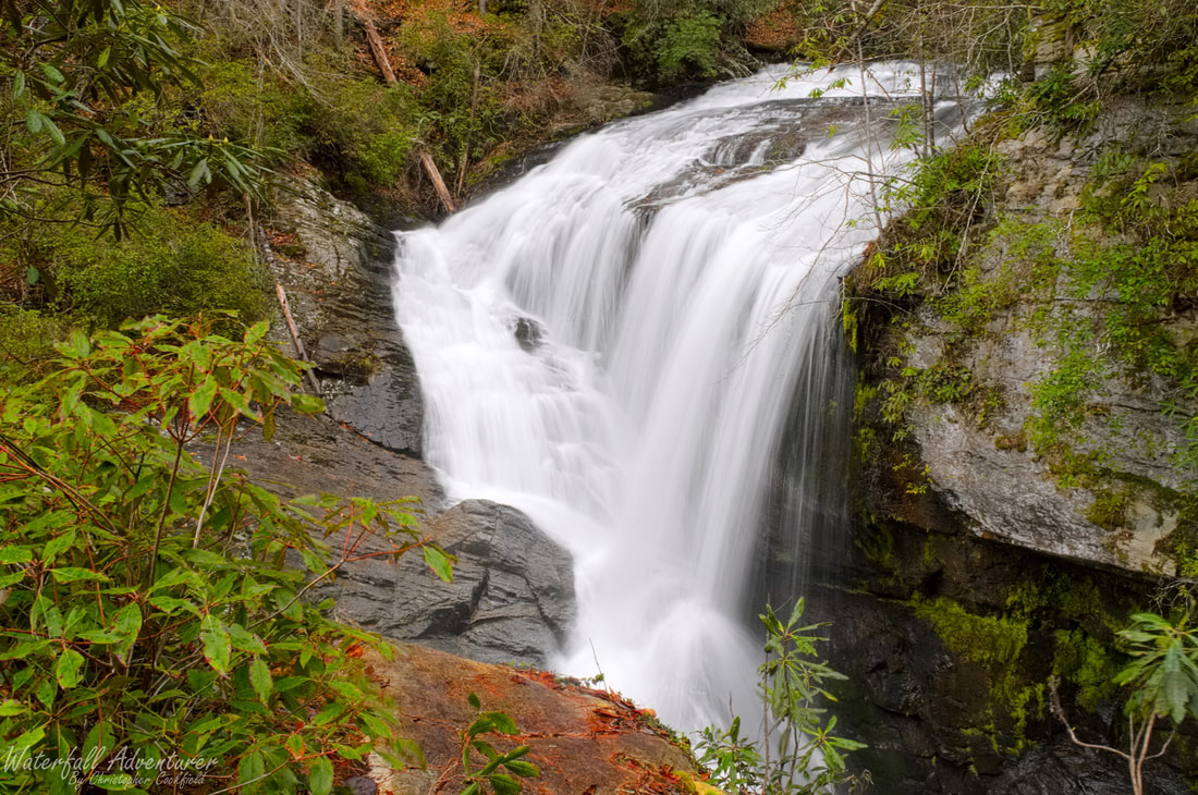
Laurel Fork Falls
- Height: 144 feet
- Type: Steep cascade into a cascading free-fall
- Stream: Laurel Fork Creek
- River Basin: Savannah River
- Elevation: 1,250 feet
- Landowner: South Carolina Department of Natural Resources
- Recreational Area: Jocassee Gorges Wildlife Management Area
- State: South Carolina
- County: Pickens
- USGS Map: Reid
- Difficulty: Accessible or easy to very strenuous
- Accessibility: Boat or road & bushwhack
- Trail Blaze: White
- Admission Fee: None
- Hike Length: 7.8 miles for the overlook and a little over 8 miles to see both levels
- Waterfall GPS: 35.03174 -82.89369
- Parking GPS: 35.04400 -82.83817
Overview
Laurel Fork Falls is one of Pickens County most beautiful waterfalls. It's hidden in a cove on the northeastern side of Lake Jocassee and makes for an awe-inspiring sight to see, be it by boat or by trail.
If you choose to hike to Laurel Fork Falls, you'll end up passing the short trail up to Virginia Hawkins Falls, which is also a beautiful waterfall.
If you choose to hike to Laurel Fork Falls, you'll end up passing the short trail up to Virginia Hawkins Falls, which is also a beautiful waterfall.
Driving Directions
From Pickens, South Carolina. From the intersection of SC-183, head northwest on US-178 for 16.7 miles and turn left onto Laurel Valley Road, just after the bridge. Keeping right at the fork, drive 3.6 miles on Horse Pasture Road to Laurel Fork Gap and park on the left-side of the road in a small parking space near the intersection of Horse Pasture Road and Canebrake Road.
From Rosman, North Carolina. From city center, head southwest on US-178 for 8.4 miles and turn right onto Laurel Valley Road, just before the bridge. Keeping right at the fork, drive 3.6 miles on Horse Pasture Road to Laurel Fork Gap and park on the left-side of the road in a small parking space near the intersection of Horse Pasture Road and Canebrake Road.
Low clearance vehicles will have a hard time on the Horse Pasture Road!
Hiking Directions
From the parking. On the east side of the road (between Horse Pasture Road and Canebrake Road) is a map of Laurel Creek Heritage Preserve and a spur trail to the Foothills Trail. Follow the spur trail behind the map for 260+ feet to a road and head right. Follow the road for over a mile to a trail sign for Virginia Hawkins Falls on the right. (You'll have several creek crossings and a switch-back on your way.) Head right and follow the trail through a campsite to two bridges and follow the trail to the left bridge. (The right bridge will take you to Virginia Hawkins Falls.) Once across the bridge, follow the white blazed Foothills trail for 1.66 miles to a cable bridge across the creek. Continue following the trail for 0.33 miles to a red and green gate on a road and follow the road for 230+ feet to another cable bridge across the creek, once across head left and left once again to stay on the trail. Continue following the Foothills Trail for 0.7 miles to a overlook of the upper section of the falls, to reach the lower section of the falls, continue following the Foothills Trail for 100+ feet to a steep ridge on the left side of the trail and follow it down to the falls. Be very careful following the ridge down, as it has a few spots that's pretty steep!
If you don't mind getting wet, you could just follow the road all the way down to the second cable bridge and then pick up the Foothills Trail to the waterfall, or you can take the easy route and take a boat from Devils Fork State Park to the waterfall, which is the handicap accessible option.
My GPS track can be found below. Click on the track name to be taken to the Gaia GPS website where you can save the track to your phone or computer.
Waterfalls Nearby
- Abbey Falls
- Bella Falls
- Big Cliff Falls
- Bonita Falls
- Bushwhack Falls
- Christopher Falls
- Creekside Falls
- Evil Ducky Falls
- Hidden Veil Falls
- Louie Falls
- Lower Doghobble Hell Falls
- Middle Doghobble Hell Falls
- Upper Laurel Fork Falls
- Virginia Hawkins Falls
